Sunday, 5 June 2016

The Floating Village of Hungary


Indeed the planet earth is full natural beauties and wonders. One of its most enchanted beauties is the floating village that lies in northwest of Hungarian capital of Budapest. Hence, forget the Maldives, the stunning floating village on stilts in Hungary screw your eyes just feels you in Paradise. Just apart from the power plant, gives the game away and the cold weather. The village is located at northwest of the Budapest nearby Bokod. In fact, this is Hungary’s answer to the paradise island in the Indian Ocean, known as the “floating village”.  

Therefore, there’re rows of vintage cabins, furnishes with cozy porches, have been built on stilted platforms in the Lake Bodoki and interconnected with land and other by a series of boardwalks. These cabins usually used in summer by local inhabitants but anglers throughout the year, due to village’s chilly location, though water never freeze. The adjacent power plant uses the lake as a cooling pond and pumps warm water into it, so it’s never freeze. 

In 2014, the floating village becomes more popular when Bing used a photograph of it as wallpaper for one of its search pages. So, for traveler lovers, keen to visit the mystical dwellings, the suggested route is to travel from the city of Oroszlány on the east side of the village. Moreover the settlement is one of numerous that have been constructed on stilts around the world in areas such as Papua New Guinea, northeastern Nicaragua, northern Brazil, south east Asia and west Africa.

This village of Bokod is so fascinating, enchanting and a completely a fairy tale scene. The village is made particularly for the holiday huts for traveler and has gained a lot of popularity for a very good reason and that is its beauty. The village is consists of just 2,000 inhabitants, have been attracting the peoples all over the world including famous celebrities. Moreover the nature of the water makes it suitable for fishing the year round, and the place has even been termed a fishing heaven. Therefore, this stunning place looks mystical, heavenly, and its unreal walkways are just beyond one’s imagination. Source: Charismatic Planet

Thursday, 2 June 2016

“The Škocjan Caves” The Natural Treasure of Slovenia


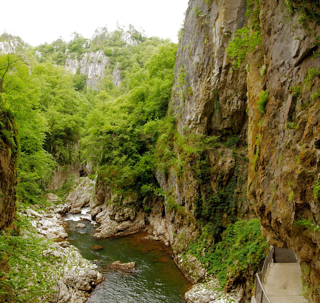
Well, Škocjan Caves is a cave system, acknowledged as one of the natural treasure in Slovenia. The Škocjan Caves have significance importance, was entered on UNESCO’s list of natural and cultural world heritage sites in 1986. Moreover, Škocjan Caves was also entered in International scientific circles ranking among most important caves of planet earth. The Škocjan Caves represents the most noteworthy underground marvels in both the Karst region and Slovenia. Currently, Slovenia is actively protecting Škocjan Caves system, established Škocjan Caves Regional Park and the Škocjan Caves Park Public Service Agency.  Škocjan Caves is one of largest known underground canyons in the planet earth, encompasses majestic natural beauty with great aesthetic vales, great microclimatic condition, a special ecosystem has developed. In 1999, the Škocjan Caves also entered on the list of Ramsar Wetlands of International importance along with the underground stream of the Reka River. 

Škocjan Caves have formed around 300 m thick layer of Cretaceous and Paleocene limestone. The length of Škocjan Caves is 6,200 m and its exceptional volume of the underground canyon is what distinguishes Škocjan Caves from other caves and places it among the most famed underground features in the world. The cave entrances are at the bottom of the two collapse dolines, big collapse doline and Little Collapse Doline. In 1819, the country councilor Metej Tominc decided to build steps to the bottom of Big Collapse Doline and decorated steps. This is the start of tourism in Škocjan Caves. So, by the time passes, the Škocjan Caves getting popular place for tourists. It is estimated that more than 100,000 visitors per year had visit the cave system. Moreover, visitors can also see the part of the underground canyon with Big Collapse Doline. Further, you can also see terraces of precipitated calcium carbonate inside Skocjan Caves.

Moreover, The Reka River disappears underground at Big Collapse Doline into Škocjan Caves, and its 1/3 flow to the Timavo River. The view of big river in the rainy season below the surface is majestic and frightening. The river is flowing through the underground canyon along 3.5km Hanke’s Channel. Therefore, at some points, the river expands into massive underground chambers, and one of Chamber named Martel’s considered largest underground chamber in Europe. The canyon ends with a small siphon, cannot accommodate enormous volume of water that pours into the cave after torrential rainfall, causing major flooding. 

 The first written evidence on Škocjan Caves originate through the 1561 map of Lazius-Ortelius and 1637 Map of Mercator’s Novus. In 1782, the famous French painter Louis-Francois painted some portions of Škocjan Caves which shows the significance of natural features in the Trieste hinterland. Hence, the systematic exploration of Škocjan Caves started with a speleology expedition in 1884. Thus, explorers reached the major portions of banks of Mrtvo jezero and discovered the Silent in 1904.  The next significant event took place in 1990, when Slovenian divers managed to swim through the siphon Ledeni dihnik and discovered more than 200 m of new cave passages. 

From the ancient times, folks have been fascinated to the gorge where the Reka River disappears underground as well as the secretive cave entrances. However, the Reka River sinks under a rocky wall; on the top of it lies the village of Škocjan, after which the caves are named “Škocjan Caves Regional Park” is archaeologically tremendously rich; though, it was inhabited starting 10 thousand years ago. Nevertheless, a valuable archaeological find in Fly Cave specifies the impact of Greek civilization. This region was surely one of the most important pilgrimage sites in Europe, 3,000 years ago, particularly in the Mediterranean, where it was of significant cult implication in connection with the afterlife and communication with ancestral spirits.

Tuesday, 31 May 2016

The Spellbinding Ruakuri Cave in the Waitomo Area


The Spellbinding photographs of glow worms illuminating the darkness in the streaks of turquoise lights inside Ruakuri Cave in the Waitomo area. This is ethereal New Zealand cave is lit up by thousands of glow worms. The Auckland based 26 years photographer Shaun Jeffers spent almost a year to capture glittering displays, proving that the country is just as beautiful below ground as it is above. In the first look, you’ll realize myriads stars are shinning at the cave roof.  The creative photographer originally belongs to Liverpool United Kingdom said; it seems a different plant and really out of the world. 

 I my entire life, I’ve never experienced such event like it, and to be very honest, it is extremely difficult to the feeling into words. The glow worm is out of world, when you standing alone in complete darkness looking up at these little glowing creatures are just so fantastic. It looks like a real life Pandora, from James Cameron’s Avatar.  I’ve heard from different sources, that glow worms are notoriously difficult to capture. In 2013, I decided to move in New Zealand to take this challenge and submerge himself to his tripod in cold water for up to eight hours a day. 

The most famous New Zealand place attracts lot of photographers to try their luck to capture stunning luminous glow worm’s phenomenon, which is called Arachnocampa luminosa. Only very few of them able to capture luminous glow worms. I am so lucky to be part of unique cave and emit a phosphorescent glow in order to catch prey and entice mates. 

Monday, 30 May 2016

The Pilot Mountain, United States

Pilot Mountain is a distinctive natural feature in the North Carolina of United States. The metamorphic quartzite monadnock rising peak is 2,421 feet above sea level, actually a remnant of the ancient chain of Sauratown Mountains. The Saura Indians, the primitive inhabitants of this area called the mountain “Jomeokee” means “Great Guide” To feel the real essence of this park, an offseason plan is ideal, when leaves are down, temperatures are mild, and least crowds are there. 

The Pilot Mountain is truly an iconic summit actually a part of the A.V.A Yadkin Valley, an American viticultural Area, U.S. Route 52 passes through the Town of Pilot Mountain near the mountain, and the City of Mount Airy in few miles farther north. The Pilot Mountain dominates the surrounding Piedmont and can be seen from many landmarks is popular and is overcrowded during the summer months. Moreover, Pilot Mountain was mapped in 1751 by Joshua Fry and Peter Jefferson, father of President Thomas Jefferson.

 The exclusive features of Pilot Mountain is Big and Little Pinnacle, have high and colorful bare rock walls, with a lovely rounded top well covered by vegetation. The visitors can take a paved road to the parking lot and campgrounds, access to the main little Pinnacle Overlook and other stunning viewing stations. Approach from any direction and see Pilot Mountain dedicated as a National Natural Landmark in 1976, this solitary peak is the centerpiece of Pilot Mountain State Park. So, Fun, from relaxation to exhilaration is easy to find there.  

Pilot Mountain is part of Pilot Mountain State Park, stretching to the Yadkin River via a corridor of Land, and associated with adjacent Horne Creek Living Historical Farm. From a distance, the ridge slope and Little Pinnacle and round knob to Big Pinnalce gives distinctive Mountain View. Pilot Mountain State Park is a popular destination for canoeing, fishing, horseback riding, picnicking, and rock climbing however, the favorite ones are rock climbing and rappelling at Pilot Mountain; offer a challenge to experienced climbers. Therefore, climbing is only permitted in designated areas; climbing and rappelling are not permitted on the Big Pinnacle. 

The rock formation on the east actually a privately held Sauratown Mountain, however Jomeokee Trail leads around the base of Big Pinnacle. There’s a picnic area down along the ride crest, follows a long cliff, most popular site for rock climbing. The other trails are Sassafras trail, Grindstone trail, connects the campground to Ledge Spring Trail.  Moreover, the Grassy Ridge Trail follows along the mountain's base, connecting the lower ends of the Mountain and Grindstone Trails together.