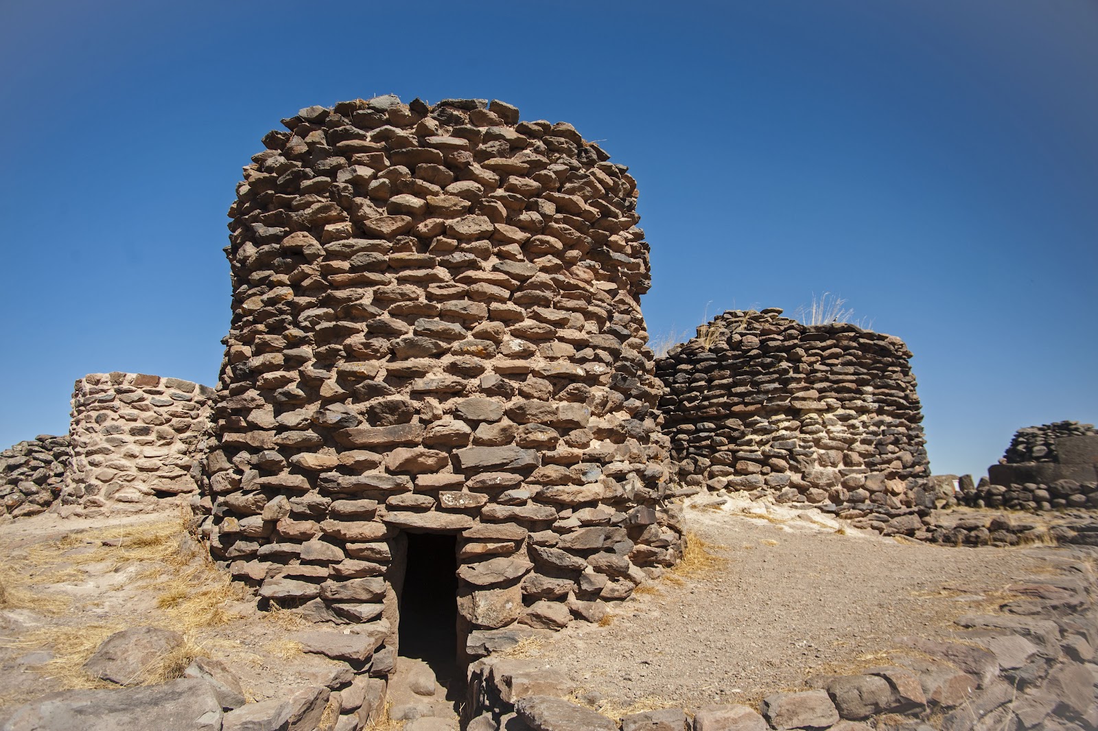
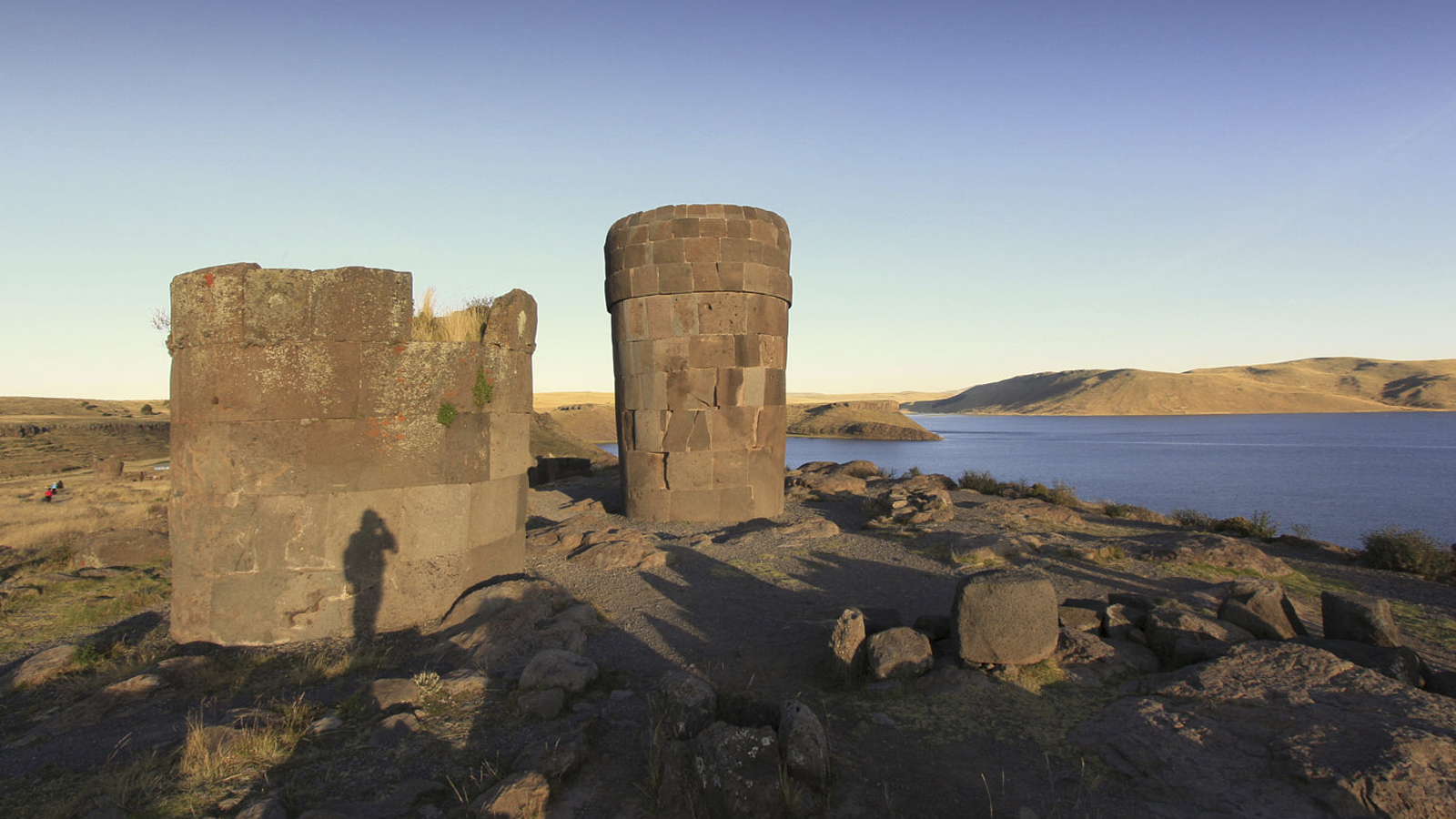
Sillustani is a pre-Inca cemetery on the shores of Lake Umayo near Puno in Peru. The tombs, which are built above ground in tower-like structures called chullpas, are the vestiges of the Qulla people, most likely a Puquina-speaking people,[1] conquered by the Inca Empire in the 15th century. The structures housed the remains of complete family groups, although they were probably limited to nobility. Many of the tombs have been dynamited by grave robbers, while others were left unfinished.
A compendium of interesting places, hidden wonders, Beautiful Places, strange travel destination, tourist attractions.
Sunday, 16 March 2025
Sunday, 21 April 2024
Mysterious Nazca Holes
A 20 meters wide band of holes, known as the "Mysterious Nazca Holes," is an archaeological site located in Cerro Viruela in the Nazca region of Peru. It consists of approximately 6,900 to 7,000 small holes with a diameter almost 1m and a depth of 50-100cm. Starting at the edge of the valley they continue uphill for a mile, the band extends in a north - south orientation over a very uneven rocky surface.
The purpose of these holes remains a mystery, they are believed to have been created by the ancient Nazca culture, which flourished in the region between 100 BC and 800 AD, or by Inca Empire. Over the years it has been suggested that they were used as war defensive positions, graves, storage pits, water collection systems, etc., but no one is sure about the answer.
Read More: Roque Cinchado – Unique Rock Formation in the Island of Tenerife
Saturday, 30 March 2024
Ancient well system at Nazca, Peru
The ancient well system at Nazca, Peru, was an important part of the sophisticated water management network established by the Nazca civilization between 100 BC and 800 AD. In addition to the underground aqueducts known as puquios, the Nazca people built wells, or cacchitos, to draw water from aquifers in the harsh desert climate. These wells were precisely engineered to prevent water contamination and provide a consistent water supply for agricultural and everyday use.
The engineering and upkeep of the aqueducts and wells demonstrated the Nazca people's sophisticated mastery of hydrology and ability to adapt to harsh desert circumstances. The Nazca well system was critical to the civilization's survival, allowing for large-scale agriculture and supporting a complex society. Nowadays, these ancient water management systems serve as a tribute to the Nazca people's ingenuity and capacity to flourish in a harsh climate. Ongoing research is revealing how significant of these outstanding accomplishments.
Read More: The Golden Chains of Laburnum
Monday, 28 August 2023
Pallay Punchu Mountain
This geological marvel tells the story of the Earth's dynamic changes through its layers of rocky rock. Located within region it offers a unique vantage point, making it a favorite destination for adventure seekers and nature lovers alike. Its geographical features, including notable geographical features, enhance its appeal. In addition to its rich flora and fauna, Pallay Punchu Mountain is a haven for biodiversity.
Diverse vegetation types and animal species make up the ecosystem, creating a delicate balance that contributes to the ecosystem's ecological significance. Nature's raw beauty can be experienced while exploring its trails. Local communities hold cultural and historical significance for Pallay Punchu Mountain in addition to its natural beauty. In addition to cultural practices and historical events, its history is entwined with cultural practices. An additional layer of enchantment is added to the experience because of the mountain's prominent role in local folklore. Your Pallay Punchu experience is enhanced by engaging with the local community. It is possible to gain insight into local traditions and community values through connecting activities.
Your journey is enriched and mutual understanding is fostered by this cultural exchange. Pallay Punchu Mountain is a photographer's paradise. If you want to capture the magic effectively, consider photography tips, such as composition advice. A professional camera or a smartphone can capture stunning shots thanks to the changing light conditions. Although the mountains are beautiful, the wilderness can be unpredictable. The implementation of safety measures, such as specific safety tips, is essential for a safe journey. It is important to appreciate the splendor of nature while prioritizing personal safety.
Source - CP
Wednesday, 13 April 2022
Guiana Highlands Flat-topped mountains disappearing into mist
MYSTERIOUS TABLETOP MOUNTAINS, shrouded with mist and lush with exotic greenery, give the Guiana Highlands the sense of a land time forgotten, tucked into a remote corner of Venezuela. The highlands stretch into the Guianas and sections of Brazil and seem a real-life Jurassic Park, in flora if not fauna.
Mount Roraima, 8,986 feet (2,739 m) tall and the most impressive of the flat mountains (called tepuis in the native Pemon language), was the inspiration for Sir Arthur Conan Doyle’s The Lost World, a dinosaur-era adventure novel.
Eroded over millions of years, the sandstone tepuis, called mesas (tables) by the Spanish, are one of South America’s oldest mountain ranges, rising like giant anvil tops above the surrounding landscape of jungle and savanna. It was only in 1935 that sections of the highlands became known to the Western world when American pilot Jimmy Angel discovered the spectacular waterfall now bearing his name, Angel Falls.
This is the highest waterfall in the world, with a 3,212-foot (979 m) cascade plummeting off of Auyán Tepuí, also called Devil Mountain. The torrent is 17 times the height of Niagara Falls. It is the highlight of Parque Nacional Canaima, one of the largest national parks in the world, the tiny village of Canaima its gateway.


.png)
.png)
.png)
.png)
.png)
.png)
.png)
.png)
.png)
.png)
.png)
.png)
.png)
.png)
.png)
.png)
.png)
.png)


