Monday 29 December 2014

Midnight Sun A Natural Phenomenon of Iceland


Midnight Sun is a natural phenomenon occurring in the summer months north of the Arctic Circle and south of the Antarctic Circle where the sun never fully sets and remains visible 24 hours a day. The video is shot completely in Ultra HD 4K resolution; however; this short time lapse film was shot during the Icelandic Midnight Sun in June of 2011. 

Furthermore the photographer says; for 17 days I’ve traveled solo around the whole island shooting almost 24 hours, even sleeping in the car, and eating whenever I had the time. During my days shooting this film I shot 38,000 images, traveled some 2900 miles, and saw some of the most astonishing, 
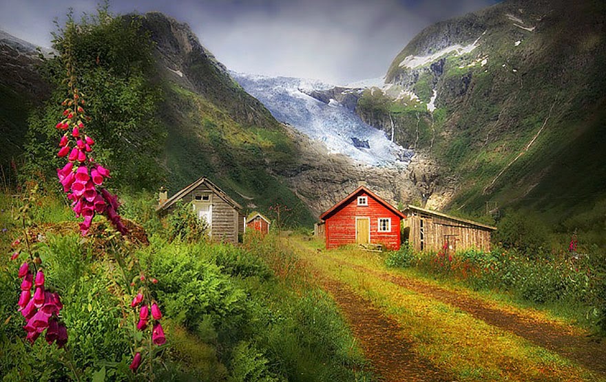
striking, and extreme landscapes on the planet. Iceland is unquestionably one of the most striking and infrequent places you could ever imagine. 

Particularly during the Midnight Sun when the quality of light hitting the landscape is very unusual, and very remarkable. Iceland is a landscape photographers ecstasy and playground, and should be number one 
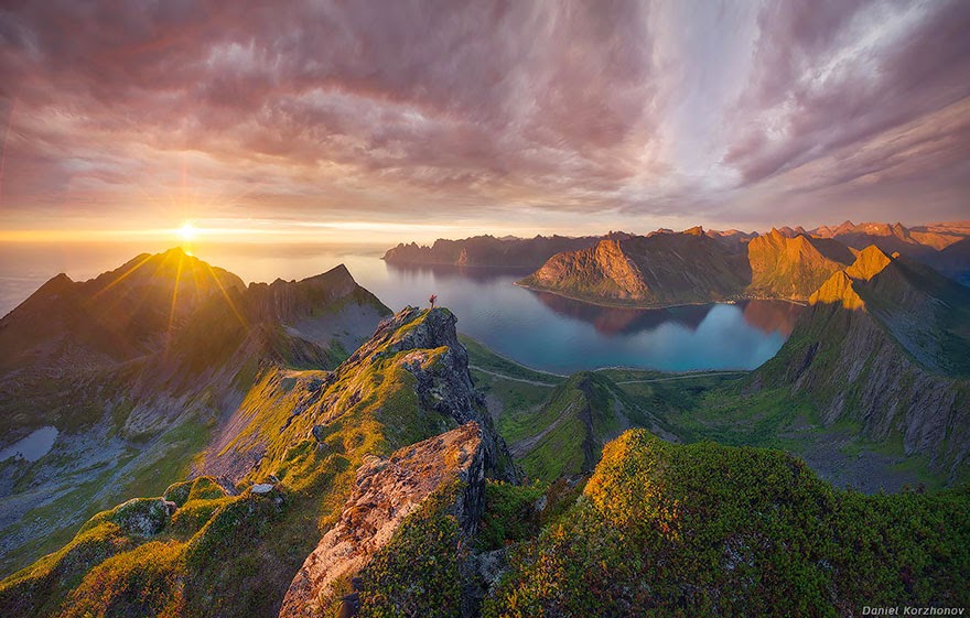
on every photographers must visit list. Iceland during the Midnight Sun is in sort of a permanent state of sunset. The sun never full sets and travels horizontally across the horizon throughout the night, as can be seen in the opening shot and at the :51 second mark in the video. 

Moreover; during the Arctic summer, sunset was at midnight and sunrise was at 3am. The Arctic summer sun providing 24 hours a day of light, with as much as six hours daily of "Golden light". Once the sun had set it wouldn't even get dark sufficient for the stars to come out, and they don't start to reappear until August. My best guidance to everyone out there, no matter you’re photographer or not, this is extremely beautiful and simple, you must visit Iceland sometime during your lifetime. You will never regret it.


Midnight Sun | Iceland from SCIENTIFANTASTIC on Vimeo.

“Masada” The Most Popular Tourist Attractions in Israel


Masada is an ancient fortification in the Southern District of Israel situated on top of an isolated rock plateau on the eastern edge of the Judaean Desert, overlooking the Dead Sea. In 37 and 31 BCE, Herod built palaces for himself on the mountain. Masada is one of Israel's most popular tourist attractions, which is 20 located at 20 KM east of Arad. Therefore; “Masada” was the first place Herod fortified after he gained control of his kingdom.

The first of three building phases completed by Herod began in 35 BCE. During the first phase the Western Palace was built, along with three smaller palaces, a storeroom, and army barracks. Hence three columbarium towers and a lovely swimming pool at the south end of the site were also completed during this building phase. According to Josephus, the troops of the Roman Empire towards the end of the First Jewish–Roman War ended in the mass suicide of the 960 Sicarii rebels and their families hiding there. A 2,000-year-old seed discovered during archaeological excavations in the early 1960s was successfully germinated into a date plant. At the time it was the oldest known germination, remaining so until a new record was set in 2012.

Moreover; the cliffs on the east edge of Masada are almost 400 meters high and on the west side it is about 90 meters high. The cliff natural approach is extremely difficult, which top of plateau if flat and rhomboid-shaped almost 550 meters by 270 meters. The casemate wall around the top of plateau is approximately 1300 meters long and 4 meters high with several towers. The fortress is well included storehouse, armory, barracks, the palace and cisterns that were refilled by rainwater. Almost all historical information about Masada comes from the 1st-century Jewish Roman historian Josephus. According to Josephus, the Sicarii were an extremist Jewish splinter group antagonistic to a larger grouping of Jews referred to as the Zealots, who carried the main burden of the rebellion.

The Sicarii raided nearby Jewish villages including Ein Gedi, where they massacred more than seven hundreds women and children. Well, in 2001, Masada was declared a UNESCO World Heritage site, here tourists can hike up, or can take cable car to the top of the mesa. Here, visitors can hike on steep hiking paths up; the first one is Snake Trail which leaves from the eastern side (Dead Sea Side), at the Masada Museum. Therefore; in 2007, a new museum opened at the site, in which archeological findings are displayed in a theatrical setting. While the other Roman Ramp trail is also very steep has less elevation gain, can be accessed from the western side of mountain.

Most hikers would prefer to start an hour before sunrise when the park opens, to avoid the mid-day heat. The intense heat can cross 43 °C (109 °F) in the summer, which is difficult to absorb for many hikers. A dawn hike up the Snake Path is considered part of the “Masada experience” a cable car operates at the site for those who want to avoid physical exertion. Please keep in mind there is a visitor center and museum available at the base of cable car. Moreover you don’t forget to take bring fresh water while hiking; however water is also available at the top.  Furthermore; a beautiful an audiovisual light show is presented nightly on the western side of the mountain. So be sure; Masada is an Israeli National Park and there is a park entrance fee. Source: Charismatic Planet

Map of Masada

Friday 26 December 2014

Gorgeous Three Peaks of Lavaredo Italy

The Tre Cime di Lavaredo also called “the three peaks of Lavaredo", Drei Zinnen, & "three merlons", are three distinctive battlement-like peaks, in the Sexten Dolomites of northeastern Italy. They are perhaps one of the best unique mountain groups in the Alps. The Tre Cime di Lavaredo is the symbol of the Italian Dolomites alone with no other peaks in the immediate vicinity, which accentuates its height and beauty.

The unique peaks are composed of well-layered dolostones of the Dolomia Principale formation, Carnian to Rhaetian in age, as are many other groups in the Dolomites. The Cima Grande “Big Peak” has an elevation of 2,999 metres and it stands between the Cima Piccola “Little Peak”, at 2,857 metres, and the Cima Ovest, “Western Peak” at 2,973 metres. Well, until 1919 the peaks formed part of the border between Italy and Austria and now now they lie on the border between the Italian provinces of South Tyrol and Belluno and still are a part of the linguistic boundary between German-speaking and Italian-speaking majorities. Since the front line between Italy and Austria during World War I ran through these mountains, there are a number of fortifications, man-made caves, and commemorative plaques in the area.

Paul Grohman along with guides Franz Innerkofler and Peter Salcher was the first person, who first accent of the Cima Grande on Aug 21, 1869 The routes of these three first ascents are still the normal ascent routes; however the Cima Piccola's route is the most tough of the three. Several routes lead from the surrounding communities to and around the peaks. Therefore; the most common route is from Paternkofel/Monte Paterno to the alpine hut Auronzo at 2,333 m, over Paternsattel to the alpine hut Dreizinnenhütte/Locatelli at 2,405 m, and then to the peaks. There’re a number of other routes as well. The hiking trails wind through several lakes surrounded by wild rhododendron, and a malga, and an alpine dairy farm, which may be serving cool glasses of fresh milk. So, along the way you will observe wildflowers, particularly the yellow alpine poppies growing unbelievably in the rugged rocky terrain. Source: Charismatic Planet

Tuesday 23 December 2014

You’ll induce to Travel to Norway to See These Amazing Pictures


From lovely forests and deep fjords to snow-capped mountains and cold, arctic tundra’s, Norway has everything for those folks who love the outdoors. They’re recently made their money beautiful, so it makes faultless sense that the rest of their country is striking as well. Norway is a geographical rarity because its length from north to south gives it one of the greatest varieties of environments in a single country in Europe from deciduous forests to arctic tundra’s. It should be a far colder and icier country than it is, but its temperatures are slightly regulated by the relatively warm North Atlantic and Norwegian currents. Nevertheless, its coasts are slashed by fjords that were carved by immense glaciers and ice sheets during the last ice age, giving its rugged northern coasts even more magnificent charm.