Showing posts with label Australia. Show all posts

Tuesday 30 January 2018

Wave Rock, Australia


Wave Rock is a strange natural rock formation located east of the small town of Hyden in Western Australia. Wave Rock name derives from the fact that it is shaped like a tall breaking ocean wave, composed of granite and the total outcrop covers several hectares. The wave rock is about 15 meters high and about 110 meters long. Wave Rock is a remarkable example of what geomorphologists call a "flared slope". A flared slope is a concave-upward or -inward bedrock surface that is naturally found around the base of inselbergs, bornhardts, and granitic boulders and also on their higher slopes. Wave Rock is 27 million years old and made up of grey and red granite strips, is quite a formation aboriginal rock paintings can also be seen at nearby Bates Cave.

The shape of the rock is not caused by a wave phenomenon, rather its rounded wave-like shape was formed by subsurface chemical weathering followed by removal of the soft weathered granite by fluvial erosion, and therefore the weathering occurred below ground level before it was exposed. The end result is an undercut base, leaving a round overhang. Further, in the spring season, water running down the rock during wetter months dissolves minerals adding to the coloring of the wave. Moreover the other aspect of Wave Rock not often shown on photographs is the retaining wall about halfway up the rock. This follows the contours and lets rainwater to be collected in a storage dam. It was constructed in 1951 by the Public Works Department, and such walls are common on many similar rocks in the Wheat-belt region of Western Australia. You will find interpretive signage around the rock; enlighten you on the history of the rock and surrounding areas. In the spring, one can find many orchids and other flowers growing around the base in the Sheoak trees.


Tuesday 26 September 2017

Shell Beach, Australia

There’s a unique beach located 45 km south east of Denham, covered shells for 60km stretch to a depth of 7 to 10m. Shell Beach is a beach in the Shark Bay region of Western Australia, on the northeastern side of the Taillefer Isthmus along the L'Haridon Bight. Shell beach is one of only two beaches in the world made entirely from shells. The beach name derived because of great abundance of the shells of the cockle species Fragum erugatum. The shells have formed a limestone that is acknowledged as coquina. However, before Shark Bay became a World Heritage Site, the coquina was mined and used for the construction of a number of buildings in Denham. Shark Bay is a UNESCO World Heritage Site, unique marine life found in and near its waters including dugongs, Indo-Pacific bottlenose dolphins, various whales and whale sharks, and the largest seagrass bank in the world, contributed to the formation of Shell Beach.
The sea-water in the L'Haridon Bight has a high salinity due to both the geomorphology and local weather of the area. The high salinity has allowed the cockle to thrive unchecked, since its natural predators have not adapted well to this environment. The shells were once used to build the office walls of buildings in the area, some of which can still be seen today. This beautiful snow-white beach is made up of millions of tiny shells transforms into a palette of the most intense greens and blues - and the water is very salty (hyper-saline), making it easy to float for those who aren’t solid swimmers. Therefore, L’Haridon Bight has been a veritable cockle paradise for thousands of years, letting the little bivalves to propagate, flourish, die, and have their shells wash up on shore over and over and over and over again, enough times to create a dazzling snow white beach. Nowadays, special licenses are still granted to mine the shells as a source of calcium for mulch and poultry feed. However, hypersalinity of L’Haridon Bight keeps out predators of humans as well as cockles, making Shell Beach a popular place to go for a swim. Also See: Cleft Island, A Granite Island of Wilsons Promontory in Australia


Tuesday 1 August 2017

Dove Lake, Tasmania Australia


Dove Lake is a corrie lake lies in the Cradle Mountain-Lake St Clair National Park in Tasmania, Australia. Dove Lake is a very popular visitor place owing to its immense scenic beauty, encircled by well-maintained walking paths which also lead up onto Cradle Mountain. The lake was named by prominent local Gustav Weindorfer after an official of the Van Diemen's Land Company. Dove Lake is formed by glaciation like several other lakes in the region. The unique flora and fauna of Tasmania were created in extreme isolation from much of the rest of the world, allowing life forms to evolve without outside influence. The Dove Lake is surrounded by towering mountains as well as fresh green plantation; walking paths lead to the Cradle Mountain for a more adventurous expedition. However, visitors need to take precautions since the area houses tiger snakes. The surrounding region houses a diversity of plants and animal species. Populations of wombats, pademelons and echidnas are found in addition to tiger snakes. The habitat is exclusive and includes the Tasmanian deciduous beech (Nothofagus gunnii), tussock grasses, snow gums and pencil pines. Moreover, numerous wombats, echidnas, pademelons and tiger snakes wandering at the shores of Lake. Dove Lake max length is 2.1 km, width is 0.7km, and shore length is about 6.5km.

The walk at Dove Lake is one of the most glorious walks in Tasmania and indeed in the world. Braved the rain and snow with two little ones in the middle of winter, and worth every step is. However, the flat, gravel and duckboard track is very easy going, leaving you to focus completely on the jagged peak of Cradle Mountain, which looms above the track. Thus, mainly depending on the weather conditions, abruptly switches from snow to sleet to sunshine in seconds. Cradle Mountain can seem brooding or pastoral or inviting, and some days its twin dolerite spires are totally obscured. Furthermore, along the way, there is a greater mix of terrain than one might expect for a walk of this distance, including scrubby button grass, sandy beaches, cascading streams and at the mid-point of the walk, a very special rainforest known as the Ballroom Forest. This enchanted stand of moss-covered myrtle-beech trees is the stuff of folk stories, and it is easy to picture magical creatures playing. Dove Lake is the most accessible place to experience this exclusive and rare landscape. The local guest facilities and lodgings can provide much comfort and modern convenience whereas investigating Earth's most ancient natural habitat.


Tuesday 13 June 2017

The Burning Mountain of New South Wales, Australia


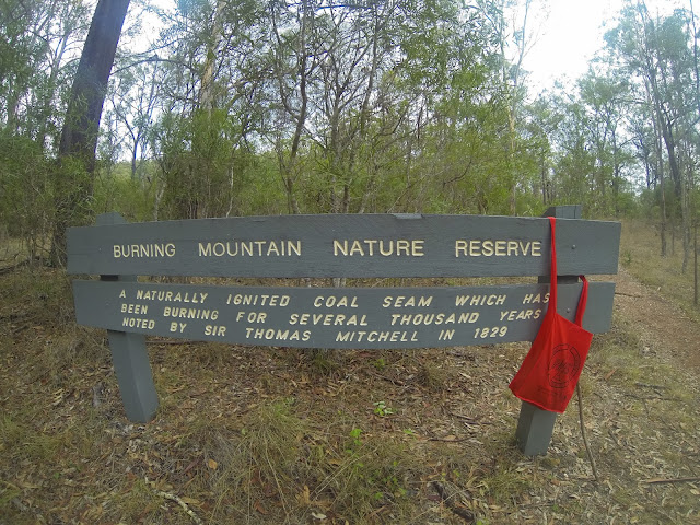
Burning Mountain, is also called “Mount Wingen”, is a hill near Wingen, New South Wales, Australia. It is located approximately 224 km north of Sydney just off the New England Highway. The mountain was discovered in 1828 by geologist T. L. Mitchell identified it as a coal seam fire. The name derives from a smoldering coal seam running underground through the sandstone, contained within the Burning Mountain Nature Reserve, which is administered by the NSW National Parks and Wildlife Service. A trail runs from the parking lots to the site where smoke emanates from the ground. The underground fire is estimated that the fire has burned for approximately 6,000 years and is the oldest known coal fire.
The underground fire is estimated to be at a depth of around 100 ft. Many explorers and settlers to the area believed the smoke, coming from the ground, was volcanic in origin. The coal fire is usually moving in a southerly direction at a rate of about 3 feet per year. The combustion has caused soil discoloration and an uneven ground surface in the area. Coal seams are extremely common across the world, and at any time there’re over 1000 burning. They happen regularly in lesser-developed mineral rich countries, but are often put out within a few days or at most a month. Moreover, considering the average duration of a coal seam fire, Mount Wingen’s fiery longevity has become something of a marvel across the globe and sightseers have flocked to observe the sulfur-tinged smoke emanating from the mountain. Though Mount Wingen has enticed sightseers in droves, it has also caused huge ecological damage to the area’s vegetation. The View from high up is very pretty and very interesting history and how the heat changes the landscape.
The Burning Mountain, heat and toxic gases from the fire have left it rocky and jagged in parts, and the land has caved in. How the mountain was first set ablaze is a mystery. Burning Mountain Nature Reserve has management strategies in place to protect and conserve the values of this park. The scientific explanation for Burning Mountain is a gradually combusting coal seam and as it eats through the coal, rocks slip into the gap, triggering fissures and slumping at the surface level. Moreover, you must be sure to wear sturdy footwear and stay on the formed track. Not only that, but watch out for fossils, too: 200 million years ago, this whole area was covered by ocean.


Thursday 27 April 2017

The Dolerite Columns of Coastal Tasmania

The coastline of the southern Tasmania is composed of spectacular rock columns that stick out up to 300 meters from the sea level. The geologists call these rocks are “dolerites”, due to its distinctive elongated shape and hexagonal columns. The Mother Nature majestic dolerite columns are probably formed in the Jurassic period, somewhere 185 million years ago during a massive volcanic event that covered up to a third of Tasmania. The doleritic clifts surpass 100 m in topography above the sea along much of the southern and eastern coast of Tasmania, and some singular columns occur as giant “totem poles” standing in the sea.

Dolerites are created when molten rocks pushed up from the deep underbelly of the earth cools rapidly and crystallize to form trifling visible crystals in the rock. However, when the rate of cooling is just right, the rocks trends to shrink in volume, because of creation of cracks. Thus, these cracks let the rocks in the interior to cool, resulting in additional cracks. Though at the end, you get a big block of rock with long vertical and symmetrical cracks creating 5 to 6 sided columns, can be just a few centimeters to over quite a lot of meters in diameter. The columns are actually a part of a continuous formation over 4,000 km long extending from Australia through Tasmania and into Antarctica.

The beautiful columnar rocks are not uncommon, as hundreds of recognized localities throughout the world where you can find them. Moreover, some of these locations are very famous such as The Giant’s Causeway in Ireland, The Devil’s Tower in Wyoming, Los Organos in Spain, and Fingal’s Cave in Scotland. The spectacular formations that, like these in Tasmania make him glorious tourist destinations.


Friday 3 March 2017

Bay of Fires, Tasmania in Australia


The Bay of Fires, on the northeastern coast of Tasmania in Australia, is a big bay that stretches for about 30 km from Binalong Bay in the south to Eddystone Point in the north. In 1773, the British navigator and explorer Captain Tobias Furneaux noticed various fires along the coast, which led him to trust that the country was densely populated. Evidence of settlement by aboriginal people can still be seen along the coast. The name Bay of Fires is associated by him, when he saw bay is characterized by white beaches, blue water and enormous granite blocks that are colored bright orange by lichens. The Bay of Fires is famous for its crystal-clear waters, white sandy beaches and orange lichen-covered granite boulders, the most popular conservation reserves. The conservation area is divided into three sections, with Anson's Bay dividing the southern and northern ends. A scenic view of the bay can be glimpsed by driving along the coast to The Gardens.
Perhaps, he named the bay after these fiery red rocks, no one knows? Moreover lichens are a mixture of algae and fungus that live together in a symbiotic relationship. The alga provides food by photosynthesis, though the fungus offers a protected environment for the algae. Thus, the combined life form has properties that are very distinct from the properties of its component organisms. Moreover, lichens are classified by their fungal component and are given the same scientific name as the fungus species in the lichen, regardless of what alga lives in the fungus.
The lichens responsible for the orange hue in the rocks of Bay of Fires belong to the family Hymeneliaceae. The beautiful color is contained in their thallus, which is the vegetative part of the body. Lichens are grouped by thallus type, since the thallus is generally the most visually protuberant part of the lichen. However in some lichens, the thallus is hard to distinguish. Which in result many lichens are remain unclassified? Aside from lichens, there’s a wealth of local wildlife to discover around the bay area, including corals birds, and the rich marine diversity that the reefs attract. Moreover, a wide range of activities are able to be pursued in the Bay of Fires area, including camping, beach activities, boating, bird watching, fishing, swimming, surfing, relaxing, walking, boat ramps, and rich marine biodiversity. But, be aware that Aboriginal middens “shell and bone deposits” are found in the sand dunes, hence do not disturb these protected sites.