Sunday 16 December 2018

Qenko, Archaeological Site in Sacred Valley of Peru

Qenko, or Kenko, is an archaeological site in the Sacred Valley of Peru. The site is located in the Cusco Region, Cusco Province, Cusco District, almost six kilometers northeast of Cusco. Qenko was declared a Cultural Heritage of the Cusco Region by the National Institute of Culture. It is one of the largest huacas in the Cusco Region. 

Many huacas were based on naturally occurring rock formations.  Inside the rock are large niches and a possible altar. This may have been a place where the mummies of lesser royalty were kept along with gold and precious objects. This sacred site occupies over 35,000 square feet and sits on what today is known as Socorro hill.

The rock is an excellent example of the Inca Rock Worship. It was thought to be a place where sacrifices and mummification took place. Qenko is the finest example of a rock artfully carved in-situ showing complex patterns of steps, seats, geometric reliefs and a puma design. On top of the rock are zigzag which served to course chicha or sacrificed llama blood for purposes of divination.  The speed and route of the liquid, in conjunction with the patterns made in the rock, gave the answers to the priest's invocations.


Qenko is made up of two areas; one is a large area, located next to the road from Sacsayhuamán to Písac. However, the small area a quarter of a mile farther back, showing remains of high walls, a circular design, and the same carefully cut stones. 


Sunday 9 December 2018

Lanzarote Vineyards – The Magical Black Gardens

In Lanzarote, Spain there is a unique cultural landscape called “La Geria”. The La Geria covers around 5,250 hectares, of which almost 3,000 acres are cultivated. The vineyards of Lanzarote are spectacular and fascinating. Semi-Circular stonewalls protect verdant vines from the persistent blowing trade winds. In the first look, you can’t even help. The cultivation of grapes in Lanzarote is unique to this part of the world. But to be impressed by endless land that’s covered black ash and volcanoes. Most of the island has treeless, moonlike landscapes with different colored soils, craters, strange rock formations, and gently sloping mountains.
  
These vines spot actually created more than 250 years ago with human hands. Each vine yields produced approximately 25KG of grapes a year. However, rains make the place seem like a miracle. The greenery you might expect to find at this tropical latitude is almost completely absent from most of Lanzarote. The young vine is placed into this human-made depression. Then, larger volcanic stones are balanced around the wind-facing edge of the hole, creating a low, semicircular barrier.

The ‘Paisaje Protegido’ – cultural protected landscape has an interesting history. In the 18th century, Lanzarote was a lush island with a thriving agriculture industry.  But massive volcanic eruptions took place in the 1730s when the entire region was covered in Lave ash. A series of violent eruptions left thick layers of ash and volcanic pebbles on the ground. That is also called lapilli, Rofe or picón. Therefore, thousands of hectares of fertile farmland were lost under up to three meters thick layers of ash. After the volcanoes had ceased to rumble, the Islanders starts to dig holes until they came upon fertile soil in areas where the lapilli was thin.

Then they began to plant vines and other fruit trees. After they quickly realized that the ash was a blessing in disguise. The lapilli is porous and has hygroscopic (water-attracting) properties. Some wineries still follow the traditional practice of using camels to haul newly harvested grapes from the vineyard to the processing areas, which are lower on the hillside.

The cool breezes from the Atlantic and the warm temperatures from the African mainland give the vineyards the kind of warm-to-cool variation that grapes need. Also, the days are warm and almost always sunny; nights are very cool.  Though annual rains fall is very low in Lanzarote. But early morning hours are very humid and allow ash to store the morning dew. The difference in temperature, known in the viticulture world as the diurnal temperature variation, is important for grapes to develop both the right amount of acidity and sweetness.


The pits were the vines are dug have to be 5 meters in diameter and 2-3 meters deep and also need a lot of space. The roots spread out in a wide circle near the surface to be able to absorb as much water as possible. The range of wines from La Geria includes the traditional Lanzarote wines Malvasia, Listán Negra, Moscatel, and Manto. To add to the mystic, tourists often arrive at the wineries' bodegas on the backs of camels. Imported from the Sahara long ago, these beasts are able to easily negotiate the soft, sandy soil and go where vehicles cannot. Lanzarote landscapes are unforgettable and you must visit once in a lifetime.
 Source: CP


Thursday 6 December 2018

The Steinhuder Meer or Lake Steinhude is a lake in Lower Saxony, Germany. The Lake is located 30 KM northwest of Hanover. It lies within a region known as the Hanoverian Moor Geest. The lake is named after the nearby village of Steinhude, has an area of about 30 square kilometers. The steinhuder Meer is the largest lake of northwestern Germany. The Lake Steinhude is very shallow, with an average depth of only 4.4 ft and a maximum depth of less than 9.8 ft.
The Steinhuder Meer is part of the glacial landscape formed after the recession of the glaciers of the latest Ice Age, the Weichselian glaciation. Nature lovers can join one of the nature and landscape tours and with luck catch a glimpse of sea eagles. The environment around the lake can be best explored as a one or two-day trip around the Steinhuder Meer.
The two theories explained the formation of Lake Steinhuder. The first one says that glaciers gouged out the hole and meltwater filled it. However the other theory says that an ice storm formed the hole and as the groundwater rose, the lake was formed. The most important is 18th century fortification small artificial island “The Wilhelmstein”.  The Wilhelmstein Island was built around 1761 to 1765 then used as a military fortress. Afterwards it was used as military school. It is located in the middle of lake. The The Steinhuder Meer is heart of nature reserve, and also used as recreational area.
The other Badeinsel Steinhude  was built in 1975 using sand retrieved from the lake. It has a sandy beach which is popular during summer.  Access to this island is via 80m pedestrian bridge from Steinhude. The lake offers the opportunity for sailing and surfing for water enthusiasts.

The Steinhuder Meer as a Tourist Place:
The lake steinhuder is famous destination for locals and for vacationists. Up to three ships offer cruises; they are supplemented by smaller boats running on schedule across the lake. The various small shops, seafood restaurants and markets invite you to take a stroll or enjoy a good meal. A beautiful bike path encircles the lake, crossing various landscapes. Source: CP


Friday 30 November 2018

The Devil’s Marbles of Karlu Karlu

 
Devil’s Marbles or Karlu Karlu, are a collection of giant granite boulders strewn across a shallow valley. Devil’s Marbles are recognized by the local Warumungu Aboriginals. It is located almost 100 KM south of Tennant Creek in the Northern Territory, Australia. The Devil’s Marble is one of the most widely considered symbols of Australia’s outback.
 
The Marbles have great importance for the Aboriginal people. They’re protected under the Northern Territory Aboriginal Sacred Sites Act. In the Aboriginal mythology the Devils Marbles are the eggs of the rainbow serpent. Many dreamtime stories and traditions of the Warumungu, Kaytetye and Alyawarre Aboriginal folks are linked with this area.
 
The unique shapes are formed by erosion more than millions of years. These marbles are made of granite with varying sizes from 50cm to 6m across. Different boulders are naturally precariously balanced atop one another or on massive rock formation. However, many others have been split cleanly down the middle. Though they are appear to have been prudently placed or maybe brought here by flood or glaciers from distant places. These boulders in fact formed on the ground they stand by erosion of rock that reached the surface from below.
 
The Devils Marbles started out, several million years ago, when an upsurge of molten rock penetrated the ground from below. It spread out and settled into a solid layer within the Earth's crust. Thus, after some time, tectonic forces caused folding of the Earth's crust in the area. Which have lifted the granite causing it to fracture into big, square blocks?
 
The weathering by water and wind rounded off the edges and turned them into smooth boulders that we see today. Moreover the extreme temperature difference between day and night in the arid desert region. Where the reserve is located creates massive stress on these boulders, that causing them to frequently expand and contract. Some of the rocks eventually crack completely in half.
 
According to one interesting story, “Arrange”, the Devil Man, while walking through the area, made a hair-string belt, a type of traditional adornment, worn only by initiated Aboriginal men. He was twirling the hair to make strings. Then he dropped clusters of hair on the ground which turned into the big red boulders. He finally returned to his place of origin, a hill named “Ayleparrarntenhe”, where the legend myths he’s still lives today.


Thursday 29 November 2018

4,000-year-old Termite Mounds Found Equal to the Size of Great Britain


Termites are tiny insects about the size of an ant. They live in colonies that may contain 2 million relatives. Despite their small size they are extraordinary builders.  In the seasonally dry, deciduous forests of northeastern Brazil, obscured by walls of thorny-scrubs, is a vast landscape made up of tens of millions of densely packed earthen mounds. The findings suggest that the over-dispersed spatial mound pattern isn’t generated by aggressive interactions.

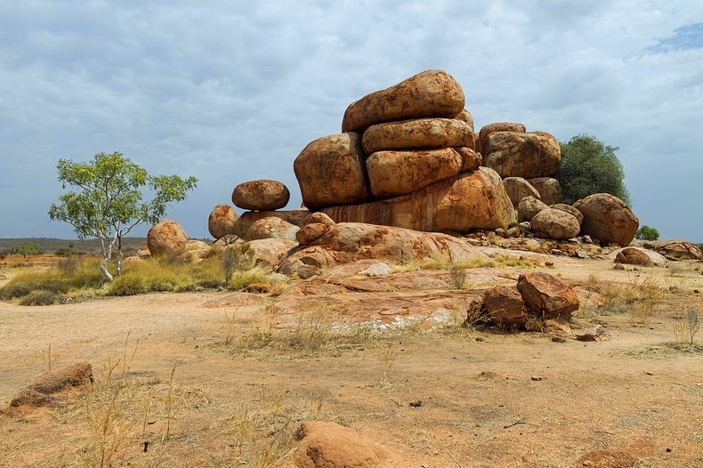
The cone-shaped are not nests, actually piles of dirt each measuring 30ft wide at its base and twice as tall as a grown man. Which are waste earths excavated by the termites when they burrow tunnels under the soil. It’s unbelievable that finding an unknown biological wonder of this sheer size and age still existing. There are lots of different kinds of termite mounds. Some of them actually keep the termites cool during the day, and a little bit warmer at night.

Investigators approximation that these are more than 200 million mounds. These are covering a huge region approximately equal to the size of Great Britain. The amount of soil excavated is over 10 cubic KM, comparable to the volume of great pyramids of Giza. The still-inhabited mounds are up to 4,000 years old and so tall they can be seen via satellite.

Therefore, this makes them the largest engineering project by any animal besides humans. Unbelievably, some of these mounds are as old as the Egypt Pyramids themselves. These mounds are remains mainly hidden from view in the deciduous, semiarid, thorny-scrub caatinga forests exclusive to this part of Brazil. The locals call them “murundus” but not too much people outside of the region have heard about it. It was only in recent decades when some of the lands were cleared for pasture that outsiders have come to discover them.

Roy Funch, from the State University of Feira de Santana, first saw these fields of mounds in the 1980s when he arrived in Brazil as a Peace Corps volunteer. A pheromone map might allow the termites to minimize their travel time from any location in the colony to the nearest waste mound.

Investigators have found that this colossal feat of engineering is the work of a tiny species of termite called Syntermes dirus, barely half an inch long. These creatures have been building this landscape for the past four thousand years, and they are still present in the soil surrounding the mounds. Soil samples collected from the centers of 11 mounds and dated youngest mound is about 690 years old, while the oldest was at least 3,820 years old.

These mounds discarded earth, have no internal structures save for a single large central tunnel descending into the ground to meet a widespread network of underground tunnels and thin horizontal galleries where the termites store harvested food. In the night, the termite workers and soldiers emerge from their underground nest and onto the forest floor through small temporary tunnels excavated between the mounds. After their work is done, they return back to the nests and seal the tunnels shut.

There are many questions still to chase. How termite colonies are physically structured because a queen chamber of the species has never been found. Some reports say the mounds can be viewed from space. They can be easily viewed on open source satellite images, including Google Earth.