Friday 2 June 2017

Thor’s Well, The Odd Natural Wonder on the Oregon Coast


On the coast of Oregon, there’s an odd natural hole that seems to be draining the sea. Thor's Well is located in the Cape Perpetua Scenic Area, just three miles south of Yachats, a natural bowl-shaped hole carved out of the rough basalt shoreline. It’s a gaping; seemingly bottomless sinkhole swallows the unbroken stream of seawater around it. This is called “Thor’s Well” a very dangerous natural wonder is known, is not bottomless.  Thor’s Well is also known as the “drainpipe of the Pacific” and some call it “Gaping Hole”. About 20 Feet deep Thor’s Well is actually a hole in the rock that only appears to drain water from the ocean. Although, the well is not quite as magic as it seems, but it still manages to produce amazing sights however not for the faint of heart!

According to Gary Hayes, a publisher of Coast Explorer Magazine, the feature likely began out as a sea cave dug out by the waves before the roof eventually collapsed, leaving openings at the top and bottom through which the ocean surges and sprays. However, it’s a circular shape aside, not so different from the other features around it- rugged Cook's Chasm, a spouting horn and adjacent Devil's Churn - but its shape and location, right against the Pacific Ocean, result in some pretty rare behavior.

Although it’s a treacherous spot, but not for the reasons people generally think. Because, the past incidents took place here, due to people foolishness, they have been hit sneaker waves while looking at the feature. Those people didn’t get sucked into hole, got plenty of scrapes and cuts against the sharp volcanic rock. After all, it's the ocean that's dangerous, not Thor's Well. A sneaker wave can drag anybody into watery grave anywhere along the Oregon coast, whether you're standing at the edge of a chasm or just walking down the beach. Thor's Well is unique by shape and behavior only - otherwise, it's just another fascinating hole in the basalt.

The Thor’s Well is most amazing site at high tide during storms; it washes water violently over the rocks and funnels into the hole. Moreover, during the sudden torrents, unwary visitors to the site run the risk of being swept right into the maelstrom. Nevertheless of high risks place, photographers and nature lovers continue to flock to the spectacular fountain to see the aggressive waters that live up to their godly namesake’s stormy personality. There are plenty of other rugged and beautiful sites all around it, but Thor's Well seems to be special. Maybe there is something mystical about it - but that power comes courtesy of the ocean, not the hole that it carved in the rock.


Wednesday 31 May 2017

The Hiran Minar, Sheikhupura Pakistan


The Hiran Minar is one of the best known and most beautiful site used to be the favorite hunting spot of all Muslim rulers. Hiran Minar  or "The Deer Minaret" is 17th century Mughal-era complex located in the town of Sheikhupura, about 40 kilometers northwest of Lahore in the Pakistani province of Punjab. Hiran Minar was built at the site of a game reserve in honors of Mughal Emperor Jahangir's pet antelope, due to his fondness of nature and relationship between human’s pets and hunting.
Therefore, Hiran Minar was built during the reign of the Mughal Emperor Jahangir in a hunting reserve used by the Mughal royals. During the region of Emperor Salim from 1605 to 1627, Sheikhupura had the status of a royal hunting ground. The minaret itself was built in 1606 as a monument to Emperor Jahangir's beloved pet antelope, Mansiraj, or "Light of the Mind". Who had been trained to lure wild animals to the tank in order to be hunted?
The practice of building such tomb-markers over the skulls of game animals is an ancient Persian custom. Mughal Emperor Jahangir ordered to build a tower and a grave for his deer, Mansraj, and he spotted a deer tried to kill, but accidentally killed his own favorite, Mansraj. The emperor becomes so sad that he ordered to bury deer in the ground where it died and build a tower called Hiran Minar. This is a very rare example of love towards a pet, a gesture of love towards wildlife in a time when the western world was even not familiar with such intentions.

The reserve was built in a scrub forest, and allowed Jahangir to get experience of sense of semi-wilderness near the imperial city of Lahore. The game-reserve was used as a park where visitors could enjoy the sport of hunting. The minaret and tank were soon accompanied by a larger pavilion, built during the reign of Shah Jahan. The Jahangir-era minaret stands 30 metres tall, and was built in 1606 as a tomb marker for the emperor's pet antelope, Minraj. The sides of the minar are inscribed with a eulogy to the pet antelope. Today after the collapse of its canopy on the top is 110 feet in height. There are 108 steps on a spiral staircase lead to the summit of the minaret where rest the remains of Mansraj. A massive rectangular water-tank pool measuring 229 metres by 273 metres lies at the heart of the complex.
Moreover at the center of each side of the tank, a brick ramp slopes down to the water, providing access for wild game that were sought by hunters. An octagonal pavilion built during the reign of Shah Jahan lies at the center of the pool. The pavilion is two-storeyed, and topped by a rooftop chhatri that served as a stone gazebo. The pavilion's architecture is similar to the Sher Mandal at Delhi's Purana Qila, built by Emperor Humayun. The pavilion was surrounded not only by the water tank, but also semi-wilderness.

The pavilion was thus likely used for recreational purposes. A causeway spans the pool to connect the minaret with the pavilion along an axis which passes through a gateway. Moreove an exclusive features of this specific complex are the antelope's grave and the distinctive water collection system. At each corner of the tank is a small, square building and a subsurface water collection system which supplied the water tank; only one of these water systems is only extensively exposed nowadays.
This is an enjoyable and calm place for picnic and to feel relax with gardens in surrounding with a lack and boating facilities. A thick keekar-jungle flanks the northern side of the pool, with winding footpaths zigzagging their way over the raised mounds. On the opposite side the pool a tree-lined garden, with a canteen and some swings and slides awaits picnickers. The Mughals emperors are famous for their love for beauty and nature. The Mughals were infatuated with gardens, forts, mosques and mausoleums, where they lived they erected a structure in any of the above form. Hiran minar is a different construction from all of Mughal places and a unique one within its theme and concept.


Wednesday 24 May 2017

Odiham Castle, Hampshire, United Kingdom


The Odiham Castle is a ruined castle lies on the banks of the Basingstoke Canal, but was built long before the canal existed near Odiham in Hampshire United Kingdom.  It is also known as King John’s Castle, one of only three fortresses built by King John during his reign.  He visited this area in 1204, selected the site to build Castle here lay halfway between Windsor and Winchester. The Odiham castle built on 20 acres of land, took 7 years to complete.  The castle had a two-storey stone keep and a square moat, raised banking and palisades. Particularly, the stronghold also had a domus regis or king's house. By the end of 15th century Odiham was used only as a hunting lodge, and in 1605 it was described as a ruin. Now a day, Odiham Castle is open for public and only visible remains are part of octagonal keep and outlaying earth works. Therefore, in Sep 2007 Hampshire County Council undertook a restoration of the shell keep under guidance from English Heritage. The Odiham Castle design was certainly unusual; the great thick walls are made up almost entirely of flint, which would have been clad in dressed stone, with narrow brick arches on some of the openings.

The most southerly corner of the moat survives in the form of a small overgrown pond on the opposite side of the canal from the rest of the castle. Whilst the Castle is well laid out and has good historical information boards. The Greywell Tunnel is only a few hundred meters away with its history and famous Bat site stories. Two series of archaeological excavations have been carried out at the castle, one in 1953, and the other is somewhere 1981-1985. Archaeologists have worked on the site for many years, excavating finds to try to determine the castles history and the role it played throughout its years of service. Today there are still several chapters that remain untold but someone can gauge a reasonable picture of how this magnificent structure would have acted as a fort, home and at one point, even a prison. Hence, if you’re looking for a tranquil spot to walk the dog or a convenient stop off along the meandering Basingstoke Canal, Odiham Castle is definitely worth a wander.


The Lost Lake of Oregon, United States

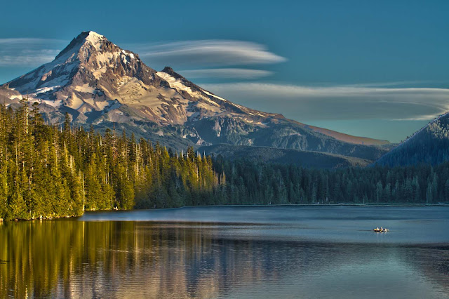
The Lost Lake is the source of a natural phenomenon that has Oregon residents stumped. When winter arrives, adjacent streams drain into the lake and cause it to fill with water. While this occurrence isn't out of the ordinary, the lake does undergo a confusing transformation in the spring. As winter comes, the lake drains like one ginormous bathtub; the hole has always been there, the shallow lake surrounded by pine trees that sits near a highway. As for its mysterious drainage, it's most likely caused by the region's spongy volcanic landscape. This particular Lost Lake is located within the Willamette National Forest just outside the Mt. Jefferson Wilderness, is one of the best known because it is easily accessible. It lies adjacent to the heavily travelled Santiam Pass Highway, Oregon Highway 20. The lake is fed by three unnamed intermittent creeks from Lost Lake Butte, and Inlet Creek from Preachers Peak.

It is believe that Lost Lake's opening is a lava tube that acts as a large drain. Unluckily, one precise question hasn't been answered. The local peoples have been speculating about where the water goes after the lake is fully drained but no one has a clue. It is believed, Lost Lake was formed about 3,000 years ago when lava flowing from the Sand Mountain Line of small volcanoes blocked a river channel to create a small basin of water which now holds the lake. The lakebed begins to fill in the late fall, when the amount of rain coming in starts exceeding the ability of the lava tubes to drain off the water, and it continues to fill all winter long in a series of rain or snowstorms. Therefore, when the rainy season peters out, the 9-foot-deep lake loses its water source, and water disappears down the lava tubes until it's gone. The lake's watery boom-and-bust cycle repeats itself every year. The lake contains brook trout, brown trout, kokanee salmon, rainbow trout, crayfish, otter, and beaver. Throughout the area are blacktail deer, squirrels, chipmunks, rabbits, black bear, cougar, and bobcat. The heavily forested area consists mostly of Douglas-fir and mountain hemlock with some cedar and white pine alder and huckleberry underbrush occurs in open areas.

However, it is not sure, where the drained lake water goes, but researchers have an idea. It likely falls down the lava tubes and seeps through layers of cracked volcanic rock as groundwater. Perhaps it may be absorbed into the porous terrain, though one thing's for sure: the hole shouldn't be plugged. If anyone was ever successful at plugging it which we're not sure they could do it would just result in the lake flooding, and the road; it's an important part of how the road was designed. More than a few small streams feed into the lake intermittently, but the lava tube drain holes are the only known outlets. The Lost Lake's water seeps into earth and refills the underground water supply that feeds springs in other areas of the forest and even offers drinking water for the community. Moreover, it is projected that the lake’s water take 7 to 10 years to filter down through all those cracks and pores before it end up in someone glass. Though, not all people are respectful of the lava tubes.

Lost Lake is classified as mesotrophic, in contrast to the large number of oligotrophic lakes in the High Cascades. The concentrations of major ions, alkalinity, conductivity and pH are somewhat above average for Cascade Lakes. The water is adequately transparent that the bottom is visible everywhere, thus this combination of characteristics indicates mesotrophic, but close to oligotrophy. The lake is also very popular to Photographers, Anything from Landscape photography to Wedding photography. It is the most photographed lake in all of Oregon, as with some of the best views for Sunrises, Sunsets, And Astro photography. The locals have been throwing trash garbage such as car parts, engines and other debris in the hole, apparently for fun or just to see if they can plug the hole. Throwing anything into the hole is strongly discouraged by forest officials as it could flood the lake and the road.