Tuesday 9 February 2016

Lake Anjikuni, The Mysterious Vanishing Village


Lake Anjikuni is incredible phenomena when entire village vanishes and nowhere to be found. Lake Anjikuni is a lake in Kivalliq Region, Nunavut, Canada. It is one of several lakes located along the Kazan River; Ennadai Lake is to the south and Yathkyed Lake is to the north.The Lake Anjikuni takes the things to the next level and disappears the entire village. 
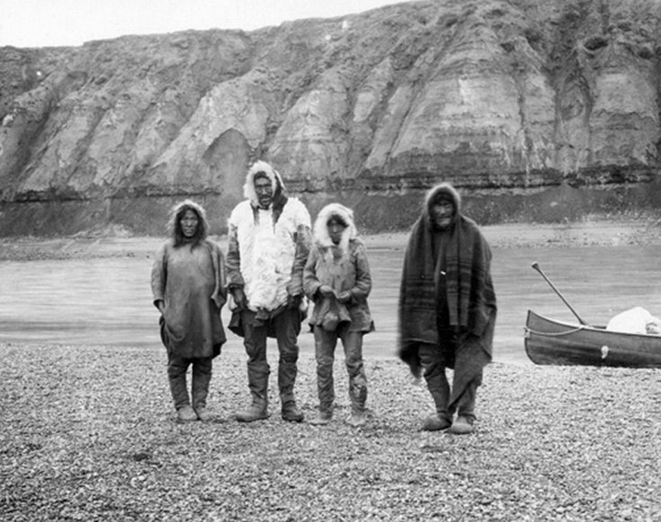
The incident took place in Nov 1930, when a trapper named Joe Labelle was looking for shelter for night. Although he was very much familiar with the village, whose population was around 2000 peoples? So, you might not believe it, he made his way there and found quite an eerie scene the villagers were nowhere to be found, everything else, including food and rifles had been left behind. Since then, the story of Angikuni Lake has been a mainstay of Canadian mystery lore.

The normal signs of life were entirely absent. Even no laughter or the hubbub of conversation was detected. Therefore, Labelle telegraphed the RCMP and an investigation started how the entire village burial ground it was revealed that at least one (sources vary) grave had been opened, clearly not by animals, and emptied. In addition, about 300 feet from the village, the seven bodies 7 sled dogs were found, having starved to death despite open stores of food at the village. However, some versions of the story even report weird lights being seen above the lake around the time of the disappearance.

Therefore, what would really happen? Not confirmed yet, however there have been all sorts of claims about the cause for the disappearance, including aliens, ghosts, and even vampires. However, RCMP’s own website disregards the story as an urban legend, but with so various versions of it floating around from so numbers of years ago, it’s extremely hard to be certain. Except about the vampires, as believe can be certain it wasn’t vampires. Currently, no physical evidence exists of a village at Angikuni Lake, and nobody has ever published an account of going up there and clearing away any remnants. So mainly trust on documentary evidence to find the real history of the vanishing village.

Sunday 7 February 2016

Grotte de Lascaux: The Famous Prehistoric Cave Printing


Lascaux is the setting of a complex of caves is the France most famous for its Paleolithic cave paintings.  The cave contains some of best known Upper Paleolithic art. These paintings are believed to be 18000 years old. The paintings primarily comprises of large images of animals. It is thought, these are best known fossil evidence to have lived in this area at that time. Therefore, in 1979 the cave was added to the UNESCO World Heritage Sites list along with other prehistoric sites in the Vézère valley. The figures, which can be grouped into three main categories: animals, human figures, and abstract signs. Lascaux cave has often been referred to well-known for their artistry, more than 2000-strong menagerie of animal images are depicted in Technicolor shades of red, black, yellow and brown, ranging from reindeer, aurochs, mammoths and horses to a monumental 5.5m-long bull, the largest single cave drawing ever found. 

The cave was totally sealed and protected for ages; until 1940 it was discovered by four teenaged boys out searching for their lost dog. It comprises a massive network of chambers well decorated with the most complex prehistoric paintings ever found. In 1948, the original cave was opened for visitors, but within 15 years it became apparent that human breath, temperature changes and introduced elements were causing irrevocable damage, and the cave was closed in 1963. Carbon dating has shown that the paintings are still a mystery why the prehistoric painters consumed so much time and efforts to their creation, and why this specific site seems to have been so significant. Moreover, the most famous section of the cave is “The Great Hall of the Bulls” where bulls, equines, and stags are depicted. 

The Devil’s Elbow, A Forgotten Notorious Double Hairpin Bend


A former stretch of road in Scotland that was so dangerous that it earned the nickname “The Devil’s Elbow” is an attraction for adventurous holidaymakers. The Devil's Elbow, is notorious double-hairpin bend often-quoted gradient of 33 percent is a myth. The modern road bypasses the hairpin bends, but the old road still exists and its route can be walked, or carefully cycled. Though the forgotten historic road overgrown with weeds and slowly disappearing, yet still heavy with the memories of its earlier life.

However, the once be scared double-hairpin bend near Glenshee, Perthshire, Braemar, and Aberdeenshire used to be part of Britain’s highest route, the A93, nonetheless was bypassed when the road was straightened out in the 1960s much to the relief of motorists. However, this road is often blocked by snow in the winter. The beauty of this road still exists, and entices hikers and cyclists, so officials are trying to bring in more tourists with a new rest stop and walking routes. The Devil’s Elbow is located a mile south of the 2,198ft Cairnwell Pass. 

However, once the double hairpin bend was Britain’s most challenging stretch of road, with warning signs push drivers to show “great caution”. In 1967, the Devil’s Elbow gets more famous, when Queen Elizabeth II is being driven to Balmoral by Prince Philip, as crowd’s wave from the roadside.  The British A93 is regularly used by classic car and motorbike fans and increasingly cyclists. Therefore, the newly planned construction will give a new life to this scenic route along eastern side of Cairngorms National Park. The tourists will motivate to get new experience and relish the breath taking landscapes of the Cairngorms. 

Tuesday 2 February 2016

Yungas Road, the Road of Death in Bolivia


The North Yungas Road also known as Grove's Road, Death Road or Road of fate is a road leading from La Paz to Coroico, 56 KM northeast of La Paz in the Yungas region of Bolivia.  In 1995 this is most dangerous road in the world as per American Development Bank Christened, about 200 to 300 travelers killed yearly along the road. The road was built in the 1930s during the Chaco War by Paraguayan prisoners. 

The risky road mention the cross markings on several points where vehicles have fallen. This dangerous route connects the Yungas region of northern Bolivia to the Captial City. This is one of the few routes that connect the Yungas region of northern Bolivia to the capital city. The road has no guard rails; width of single vehicle only 10 feet makes it most scary road in the world. The alongside cliffs up to 2,000 feet, make the horrible condition during rainy season from Nov to Mar. Driver visitiability is hamper during fog and rain and water runoff can turn the road into horrifying muddy track affecting traction. However, in the summer season, rockfalls are common scenario and vehicle dust limits the driver visibility.   

Moreover, the local road rule specifies that the downhill driver never has the right of way and must move to the outer edge of the road. This rule forces the downhill vehicle to stop and give the way to other vehicle. So, in that way passing can be negotiated safely. Therefore, the rest of Bolivia, vehicles are essential to drive on the left side of the road, to give the driver a better view of the vehicle's outside wheel and making passing safer.

The scary road made it more popular destination, enticing more than 25000 thrill seekers every year. However, motor biking enthusiasts made it exclusively favorite road for downhill biking, as 64 KM stretch of continuous downhill riding with only one short uphill section. Therefore, tour operators taking the benefit of it, and catering this activity, providing guide lines, information, transport and equipment. Nevertheless, the “Yungas Road” remains dangerous; about 18 motor cyclists have died on the road since 1998. The Yungas Road has been featured in BBC show “TOP GEAR” & many other TV programs.  However, a Mitsubishi Outlander TV commercial was the first ever filmed on the road.

Therefore, a new alternative route of Yungas Road was updated during the last 20 years or so, included enlarging carriageway from one to two lanes, constructing asphalt pavement, and building a new section between Chusquipata and Yolosa, bypassing to the north one of the most dangerous sections of the old “Death Road”.  This new route features modern construction consists of bridges, drainage, multiple lanes, pavement, guardrails and many other elements that make it significantly safer than the original route. The original “North Yungas Road” is presently much less used by traffic, even though an increasing number of adventure travelers bike it. A fatal accident happens there every couple of weeks, 100-200 people perish there every year. Source: Charismatic Planet