Tuesday 8 September 2015

Greenland's Uncover Hidden Gems


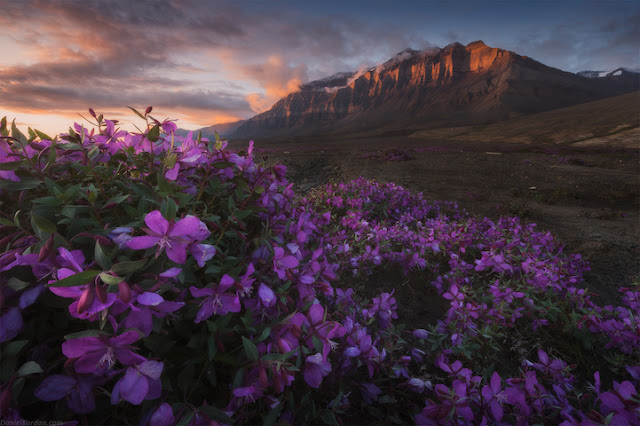
Russian photographer “Daniel Kordan” in the recent times returned from a sailing excursion to Greenland, bringing back with him loads of stunning pictures that he captures the majestic beauty of the expanse between Saint Petersburg and Greenland. Well, for last few months, he lived aboard a yacht out on the Atlantic, where Kordan led photography workshops that took advantage of the remarkable natural surroundings. Therefore, from morning to night, he and his fellow voyagers explored wonderful icebergs, caves, glaciers, and cliffs at each landing. As their journey goes on, ever day promised something new discoveries as one day, Kordan stumbled upon hidden gems in the icy wild. He says; I was so admired with Jack London stories from my childhood and my Greenland expedition reminds me his stories. Luckily we had the great chance to ask the photographer a few questions about his unbelievable adventure.

He expresses his journey in exciting words; it was a unforgettable sailing expedition to Greenland. We used the yacht Peter the First to sail from Saint Petersburg to Greenland through Iceland and the Faroe Islands. Therefore, our journey took us two months to get to Greenland and the same time to return. We invited photographers to some stops on our way for weekly sailings around Greenland. It was a kind of photography workshop for them. Indeed this was our first experience to exploring “Disko Bay” and the “islands of Baffin Bay”. I wanted to travel more and more to Greenland, because this area has several remote and unmapped areas that are perfect for photography. Believe me, it wasn’t that easy, but we were captivated by the lovely nature and the chance to explore new areas every day. Our team consists on friendly and hard-working sailors. The captain of Peter the First and his crew made the world record quite a few years ago they circled around the North Pole in just one season. Therefore, we got a valuable experience and learned a lot of legends from locals. We’ve found gorgeous fjords and mountains, and we hiked up to elevations 1 kilometer above the sea to look at ice caps. Moreover, we’ve found a marmor cave leading far into the glacier, and we discovered an old whale cemetery. One of the most enjoyable experiences was bathing in the hot springs of Greenland. We’ve found numerous hidden beaches and hot lakes.

Saturday 5 September 2015

SAIL Amsterdam, Biggest Attractions in Holland


SAIL Amsterdam is one of the biggest attractions in Amsterdam Holland, and the greatest nautical spectacle in the world where scores of tall ships and thousands of other historical ships gather along the river IJ for a wonderful parade. SAIL Amsterdam inaugural edition took places in 1975, under the name “'Sail Amsterdam 700” to celebrate the 700th anniversary of Amsterdam and it is the largest free public event in the world. At the heart of this internationally popular event is an incomparable flotilla of Tall Ships, maritime heritage, naval ships and inspiring replicas. Furthermore to the vessels themselves, each day offers up a diverse program of cultural and sporting activities of broad public appeal. The successful event proved such a big success that a 2nd edition was planned in 1980. Therefore, in order to deliver solid direction, the “SAIL Amsterdam Foundation” was established in 1977. After that, SAIL has returned to Amsterdam’s waterways organized every 5 years regularly between August 19 to August 23, during which the ships take part in several events such sailor choirs or re-enactments of naval battles to display the city’s maritime legacy. SAIL Amsterdam 2015 will totally astonish you. Therefore, days prior to the occasion you can get a preview of the astounding fleet in IJmuiden, where the ships gather for the parade. This so-called “PreSail Ijmuiden” also entices thousands of boat lovers, water sports enthusiasts and curious people.

On the wharfs, the SAIL program organizes sporting events and children’s activities and remarkable fireworks shows at night. Apart from the participating ships, thousands of smaller yacht and boats filled with audiences join them making an exclusive sight. The success of Sail Amsterdam 700 led to the establishment of the Stitching Sail Amsterdam (SSA, Foundation Sail Amsterdam) has been organizing the event every 5 years. The event is highly believed to be inspired by the “Eerste Nederlandse Tentoonstelling op Scheepvaartgebied” literally, “the First Dutch Exhibition in Shipping Technology” that was organized in the summer of 1913. Moreover, to the real ships that visited Amsterdam, there were exhibitions that displayed models of modern boats, and paintings and drawings of historic ships. Moreover, to relax the spectators there is concerts and rowing competitions were also organized. Sail Amsterdam 2015, the ninth edition of the sailing event, will be held on scheduled date of 19 August until 23 August 23, and is likely to be attended by 2 million people. The exhibition ended with large fireworks, which is also a sightseeing view, perhaps life time view.  

Friday 4 September 2015

Kata Tjuta, A Group of Large Dome Formation in Central Australia

Kata Tjuta, is also called “Kata Joota”, and also famous as “Mount Olga” or colloquially as “The Olgas”, are a group of large domed rock formations “bornhardts” cover an area of 21.68 km2 located about 365 kilometers southwest of Alice Springs, in the southern part of the Northern Territory, central Australia. Both Uluru, and Kata Tjuta / Mount Olga form are the two major landmarks within the Uluru-Kata Tjuta National Park. The majestically beautiful 36 domes that made up of Kata Tjuta / Mount Olga are composed of conglomerate, a sedimentary rock containing of cobbles and boulders of varying rock types as well as granite and basalt, cemented by a matrix of sandstone. Moreover, the alternative name, “The Olgas”, comes from the tallest peak, Mt. Olga, which is, highest point is 3,497 feet above sea level. In 1872, Mt. Olga was given name by Ernest Giles in the honor of Queen Olga of Wurttemberg. In 15 December 1993, a dual naming policy was adopted that allowed official names both traditional Aboriginal name and the English name. As a result, Mount Olga was renamed Mount Olga / Kata Tjuta. However, on 6 November 2002, the dual name was officially reversed to Kata Tjuta / Mount Olga.

The region organized an event known as the Woodroff Thrust, thrust granulite facies rocks northward over low-grade metamorphic rocks. The ultimate erosion of the formation resulted in a molasse facies, or deposition in front of rising mountains, though in this case the Petermann Orogeny, to make the deposit recognized as the Mount Currie Conglomerate. The Mount Currie Conglomerate is made up of predominately of basalt, granite porphyry, gneiss and volcanic rock fragments with a matrix composed of angular quartz, microcline and orthoclase among other minerals. Anangu are the traditional owners of Uluru-Kata Tjuta and the land around and they have been at this place from unidentified time. Although Anangu people have connected to the area for thousands of years and some historical records advice they may have been there for more than 10,000 years. They have always known that this is a very special place. There’re “Many Head” the huge rocks are separated by steep-sided gorges and valleys. Walking tracks lead around the area to lookouts, waterholes and picnic areas, while the main trail, Valley of the Winds, is a 7.5-km loop.

Uluru-Kata Tjuta National Park is so-called Red Centre of the continent and is a UNESCO World Heritage area. Both Uluru “Ayers Rock” and the Kata Tjuta “Mount Olga” are made of sediment originating in this Mount Currie Conglomerate and both have a chemical composition alike to granite. Scientists predict the rock dating have been given it an age of 600 mya, matching the date of the Woodroof Thrust event. Therefore, the actual fresh rock that makes up the Kata Tjuta / Mount Olga and Uluru / Ayers Rock are medium to dark gray with green or pink hues in some laminae. The bright orange-red hue, for which the structures are noted, is due to a patina over finely divided feldspar coated in iron oxide.There are several Pitjantjatjara Dreamtime legends accompanying with this place and undeniably everything in the vicinity including, of course, Uluru / Ayers Rock. A vast number of legends surround the great snake king Wanambi who is said to live on the summit of Kata Tjuta / Mount Olga and only comes down during the dry season. The majority of mythology surrounding the site is not unveiled to outsiders in particular to women. As is the custom, should women become identified to the "men's business" they are susceptible to violent attacks, even death. Kata Tjuta / Mount Olga can be accessed via Ayers Rock Airport. It is then a 55 km drive south, then west. Tourists have to pay National Park entry fee. The park is protecting hundreds of plant species, 24 native mammal species and 72 reptile species. To protect these, off-road access away from Uluru and Kata Tjuta is not allowed.

Kata Tjuta is most beautiful when viewed at sunrise or sunset. If you’re after some serious adventure, you can even grasp how incredibly ancient and strangely imposing Kata Tjuta is by tackling the moderately hard Valley of the Winds Walk. It is highly suggest to walk early in the morning as it makes a much comfortable. Therefore, if the climate is suitable for walks then visitors are allowed to walk, hence if temperature is 36 degrees or more, then walk is closed from 11am at the Kalpa lookout. So, early morning walk is best to avoid disappointment. If the temperature is due to be 36 degrees or more then this walk is closed from 11am at the Kalpa Lookout, so get there early to avoid disappointment. Another 2km walk that is available is the Olga Gorge Walk (Tatintjawiya), which walks into the beautiful gorge. The nearest accommodation to the Olgas would be at the Ayers Rock Resort, where there is a range of accommodation to suit all tastes and budgets. There's a picnic and sunset-viewing area with its glorious, blood-red best at sunset.

Thursday 3 September 2015

Newspaper Rock, Covered with Hundreds of Ancient Indian Petroglyphs


Well, in San Juan Country, a 200 square foot Newspaper rock surface is covered by hundreds of ancient Indian Petroglyphs, the rock art chiseled and pecked into stone. Newspaper Rock is situated right next to Utah Route 211 about 45 kilometers northwest of Monticello and 85 km south of Moab. It’s difficult to know the exact date of petroglyphs, because they have been pecked into the rock’s outer layer of natural varnish, rather than painted o. However, the historical data is approximately 2,000 years old of human doings in the area, just like a newspaper. Though they’re distinctive of several sites throughout the United States and these petroglyphs are one of the largest, safely preserved and effortlessly accessed groups in the Southwest.

These petroglyphs feature showing a mixture of animals, human, different material and abstract forms are representing the Fremont, Anasazi, Navajo and Anglo cultures. These petroglyphs can be easily found on the vertical Wingate sandstone cliffs on the upper end of Indian Creek Canyon. The images are embossed on Newspaper Rock have been adorned into the dark coating on the rock, can be called desert varnish, actually a blackish manganese-iron deposit that progressively forms on exposed sandstone cliff faces owing to the action of rainfall and bacteria. Therefore, the ancient artists use to etch more than 650 figures and patterns on the rock by pecking the coated rock surface using sharpened tools to eliminate the desert varnish and expose the lighter rock beneath. The older figures are themselves becoming darker in color as new varnish gradually develops. Hence, the first carvings were made about 2,000 years ago by the “Anasazi” peoples who were best recognized for their stone and earth dwellings rather than their art.

The Fremont people, who were contemporaries of the Anasazi, also contributed to the Newspaper Rock. They’ve etched bulky human frames with trapezoidal torsos, as well as some of the bighorn sheep, and perhaps several of the handprint and footprint shapes. Later, the Utes and Navajo people added figures portraying hunters on horseback, and images of warrior shields and wheels. In the recent times the carvings were made in the early 20th century, by the first modern day explorers of this region who left their mark with initials and names carved all around the margins of these ancient, ineffable images. 

These days, the Newspaper Rock is now protected by a fence that keeps tourists 10 feet away from the rock surface to avoid vandalism. The monument has free entry, however no best facilities apart from a carpark lot, sometimes with Indian jewelry sellers in attendance. Nevertheless the setting is peaceful and satisfied sheltered, as the canyon at this point is quite narrow, overgrown by bushes and tall cottonwood trees, with the clear waters of the creek flowing close to the road, and sheer reddish cliffs rising 250 feet above.  There is a good picnic area on the far side of the road.