Friday 26 December 2014

Gorgeous Three Peaks of Lavaredo Italy

The Tre Cime di Lavaredo also called “the three peaks of Lavaredo", Drei Zinnen, & "three merlons", are three distinctive battlement-like peaks, in the Sexten Dolomites of northeastern Italy. They are perhaps one of the best unique mountain groups in the Alps. The Tre Cime di Lavaredo is the symbol of the Italian Dolomites alone with no other peaks in the immediate vicinity, which accentuates its height and beauty.

The unique peaks are composed of well-layered dolostones of the Dolomia Principale formation, Carnian to Rhaetian in age, as are many other groups in the Dolomites. The Cima Grande “Big Peak” has an elevation of 2,999 metres and it stands between the Cima Piccola “Little Peak”, at 2,857 metres, and the Cima Ovest, “Western Peak” at 2,973 metres. Well, until 1919 the peaks formed part of the border between Italy and Austria and now now they lie on the border between the Italian provinces of South Tyrol and Belluno and still are a part of the linguistic boundary between German-speaking and Italian-speaking majorities. Since the front line between Italy and Austria during World War I ran through these mountains, there are a number of fortifications, man-made caves, and commemorative plaques in the area.

Paul Grohman along with guides Franz Innerkofler and Peter Salcher was the first person, who first accent of the Cima Grande on Aug 21, 1869 The routes of these three first ascents are still the normal ascent routes; however the Cima Piccola's route is the most tough of the three. Several routes lead from the surrounding communities to and around the peaks. Therefore; the most common route is from Paternkofel/Monte Paterno to the alpine hut Auronzo at 2,333 m, over Paternsattel to the alpine hut Dreizinnenhütte/Locatelli at 2,405 m, and then to the peaks. There’re a number of other routes as well. The hiking trails wind through several lakes surrounded by wild rhododendron, and a malga, and an alpine dairy farm, which may be serving cool glasses of fresh milk. So, along the way you will observe wildflowers, particularly the yellow alpine poppies growing unbelievably in the rugged rocky terrain. Source: Charismatic Planet

Tuesday 23 December 2014

You’ll induce to Travel to Norway to See These Amazing Pictures


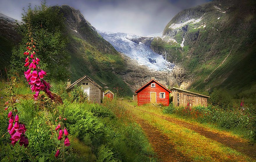
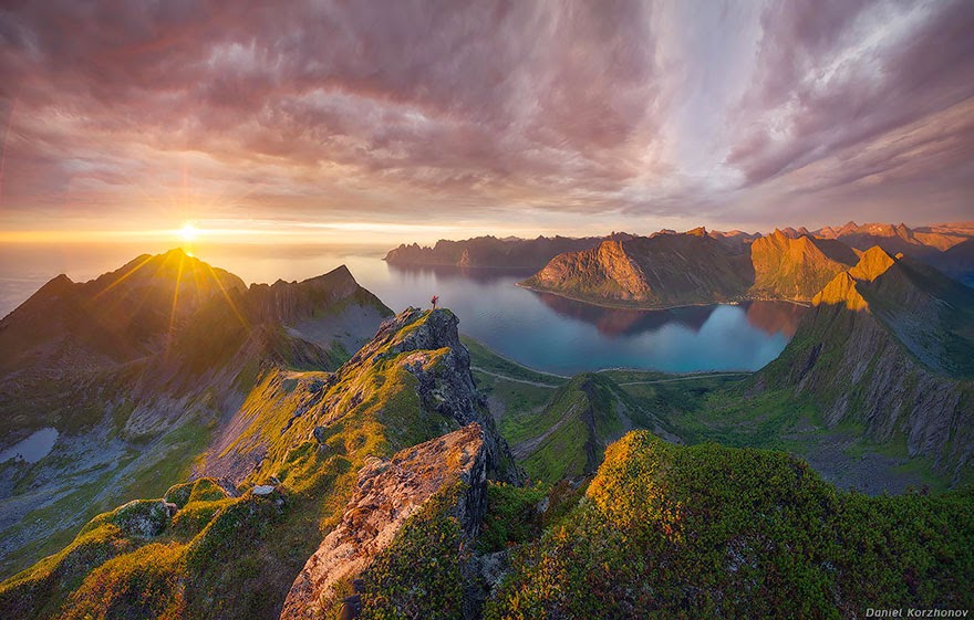
From lovely forests and deep fjords to snow-capped mountains and cold, arctic tundra’s, Norway has everything for those folks who love the outdoors. They’re recently made their money beautiful, so it makes faultless sense that the rest of their country is striking as well. Norway is a geographical rarity because its length from north to south gives it one of the greatest varieties of environments in a single country in Europe from deciduous forests to arctic tundra’s. It should be a far colder and icier country than it is, but its temperatures are slightly regulated by the relatively warm North Atlantic and Norwegian currents. Nevertheless, its coasts are slashed by fjords that were carved by immense glaciers and ice sheets during the last ice age, giving its rugged northern coasts even more magnificent charm.

Friday 19 December 2014

Herodium: The Palace and Tomb of King Herod

This place is located somewhere 12 kilometer south of Jerusalem, in the Judean desert. The Herodium is looks like an extinct volcano, but actually it is a fort built by King Herod the Great between 23 and 15 BC. King Herod’s palace and fortress was strongly built atop a natural hill, raised to a greater height by heaping earth around the walls, forming a cone-shaped mountain. The complex was well surrounded by double walls 7 stories high, within which Herod built a palace that included ample halls, courtyards and opulent bathhouses. Therefore at the base of the fortress was an inspiring royal compound with splendid gardens. A distinct aqueduct brought water to the desert from the area of Solomon’s Pools near Bethlehem. Being the highest peak in the Judean desert, Herodium commanded a spectacular view, overlooking the desert with the mountains of Moab to the east, and the Judean Hills to the west.

According to the Roman Jewish historian Josephus, Herodium was built on the site where Herod won a triumph over his Hasmonean and Parthian enemies in 40 BC. To honor the memorable event, the king built a fortress and a palace there, which he named after himself. He also built, in the plain below the hill, an administrative center for the region. The reputation of Herodium to the king is clear from the fact that it is the only monument he built to which he gave his name. Therefore since the place had slight strategic value to warrant the structure of a fort, so it is well believed that Herodium’s solitary purpose was to provide a place for the king to live out his last years.

However; after the death of Herod’s in 4 BC, Herodium became part of the kingdom of his lad Archelaus, who ruled for about ten years. The Roman procurators then held the place until the outbreak of the Great Revolt in 66 AD. As a result during this revolt, rebels entrenched themselves at Herodium until the Romans defeated them in 71 AD. The fortified mountain palace served as a vital center for the rebels during the Bar Kokhba Revolt in the 2nd century. As part of their defense measures, the rebels dug secret tunnels around the cisterns, and hid there. These tunnels can still be explored these days.

The site remained deserted until the 5th, when a big community of monks took residence in the area and built 4 churches at the base of the hill. While the settlement at Lower Herodium continued to exist until the 8th century, after which Herodium lay abandoned. It was only in the 1970s, that archaeologists initiated exploring the site. As the excavation advanced, widespread restoration was carried out on the structures of Herodium. Nowadays it is possible to walk on a contented path to the top of the fortress, to climb its walls and to enjoy, as in the past, the view of the surrounding region.

Monday 15 December 2014

Stunning Igloo Hotel with Private Pools, Mountain Saunas and Candle-lit Suites


Well, imagine in this winter, you’re in this hotel which is carved out of the surrounding snow, with igloo rooms, romantic suites and even an outdoor whirlpool for the valiant guests. The Iglu-Dorf hotel is rebuilt every season from 3,000 tons of snow at 6 locations from the Alps to the Pyrenees. The Swiss igloos, built in the Bernese Oberland and beautifully surrounded by 9,000ft mountain peaks, comes with artworks carved into the walls by artists from around the world, candle-lit suites for romantic visitors and even saunas among the mountains. It is open from 25th December to April, and every village’s sleeps up to 38 guests, cocooning them in cozy sleeping bags on thick sheepskin rugs, designed to withstand temperatures of minus 40C. And in the morning, there’s a huge buffet of croissants, cooked meats, pastries, cereals, cheese and coffee. The cost for one in a standard Iglu-Dorf igloo is 99euros (£68) from Monday to Thursday and 115 euros from Friday to Sunday.

The site shows the great multiplicity of works in rooms and common areas of the exceptional accommodation from traditional Inuit works to artists from Switzerland and much further abroad.  Artists armed with no more than an ice pick, motorized saw and shovel, produce life-like animals like seals, arctic wolves, polar bears and whales, striking designs and patterns, or even super heroes. It's an elaborate and classy scene compared to the basic igloo Gunter first constructed with friends on a mountain in a bid to be first on the slopes in the morning.  The company says 99 % of their visitors stay one night only. Therefore we don't generally recommend more than one night because we neither have running water, nor showers.  Each village caters for 38 guests a night, all of who bed down on a thick sheepskin rug in cozy sleeping bags equipped for minus-40 degrees Celsius. Nighttime entertainment doesn't extend much past mulled and good conversation, though there’s a private whirlpool and saunas.

Saturday 13 December 2014

The Rock Piller of Krasnoyarsk Stolby Nature Reserve


Krasnoyarsk Stolby Nature Reserve is situated on the southern bank of the Yenisei River, bordering the city of Krasnoyarsk, in Russia. The foremost attraction of the park is its towering stone pillars that have peculiar curved forms and reach up to 100 meters in height. These rocks are mostly of sedimentary and volcanic origin, aged from the Cambrian period, almost over 600 million years ago, to the Carbon period. They were shaped when molten magma penetrated the surface from a depth of 500 to 1500 meters into a layer of peneplain where it formed a system of cracks that spread naturally across the whole layer. Selective weathering along those cracks led to the formation of mattress-like prismatic detachments, which caused unique shapes on the rock outcrops. The place was discovered in 1624 by Russian kozaks - the explorers of Siberia, who built a small fortress at the influx of the Kacha River into the Yenisei. They wondered at the enormous intricately shaped stony blocks rising amid a thick forest and gave them the biblical name "Stolpy", abridged later to the widespread "Stolby", plural for “stolb” which means “pillar” in Russian. Since then the name came into use for these and any similar rocky features in Siberia and the Russian Far East and was accepted as a geological term. Stolby is also a major rock climbing site. A lot of local climbers deliberately do not use any belaying equipment, an ability the Krasnoyarsk rock climbers have mastered over the years. They call their exciting sport stolbism, famous elsewhere as solo climbing.