Tuesday 12 August 2014

Sabri Waterfall or Sabri Abshar Pakistan


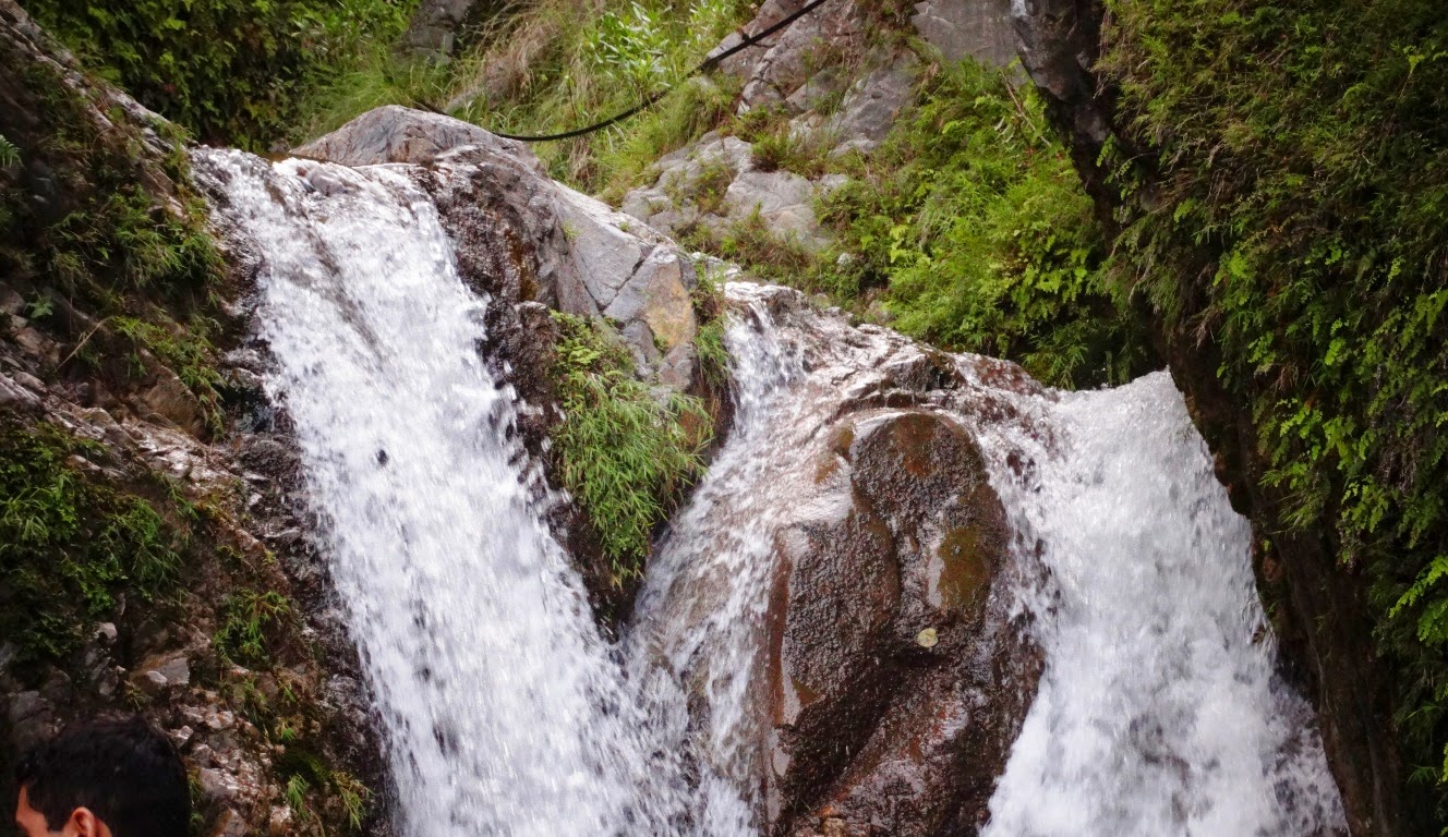
Sabri Waterfall is located in sub-locality, Moolia locality, Abbottabad District Khyber Pakhtunkhwa State of Pakistan Country. This is small waterfall just few kilometers away from Neleem River. This is a true nature water source, known as Sabri Waterfall or local people called as “Sabri Abshar”. Sabri Waterfall is worth while visiting place, with fresh water moving all the way down to fresh you. The cool water makes your mood fresh. 

Sabri waterfall is not famous so far, but now it is getting popularity in this region. The visitor’s numbers are increasing with every season passed. Up to some extent it is new tourism spot in Moolia Kass. It is very close to the place where Moolia Bakote Kass meet and that place too is very popular in tourists now. Just like the Neelam valley. The waterfall is not too much far from Kohala River Picnic point. I’d say it is only 20 minutes’ drive from Kohala Bridge. 

There will be rising opportunities for local inhabitants for small business and also for transporters as well, but at the same time they should not try to get any unfair advantage from these visitors by raising the prices of goods or service charges. Such type of small tourism spots are not less than a treat for natural beauty lovers & adventure seekers and it’s their responsibility to respect the culture of the area and try to keep it clean & calm. Here are some pictures of Sabri waterfall taken by me in my recent visit in August 2014. This is must see place for those people who are bored from Murree rush. Although Murree is the main tourist attractions in the hilly area of Pakistan, but this place is really unique one, where you can relish your time with your family. Source: Charismatic Planet


Sabri Abshar or Sabir Waterfall from Tauheed Ahmad Nawaz on Vimeo.

Monday 11 August 2014

Jabel-Al Tariq or Rock of Gibraltar


The Rock of Gibraltar is a monolithic limestone promontory located in a strategic position at the British overseas territory of Gibraltar, off the southwestern tip of Europe on the Iberian Peninsula. It is 1,398 ft high and most of the Rock’s upper area is beautifully covered by a nature reserve, which is home to around 250 Barbary macaques. These macaques, as well as a labyrinthine network of tunnels, entice a large number of tourists every year.

The Rock of Gibraltar is the only landmark of the region. At its foot is the densely populated city area, home to nearly 30,000 Gibraltarians and other nationalities i.e., British, Moroccans, Indians and Spanish. Gibraltar is Famous Worldwide for its dramatic rock, because it overlooks the Straits of Gibraltar and is linked to Spain by a narrow isthmus. It is more interesting that Gibraltar is imposing but small and measures less than 6 square kilometres in total. There is also a colony of the famous apes, the only ones in Europe to run free in a semi-wild state.

Gibraltar is a British self-governing oversees territory (colony) that is responsible for Gibraltar's foreign affairs, defense and the political stability of the colony. Though, the Rock has its own Chief Minister, Fabian Picardo, plus a House of Parliament and a government, which oversees the day-to-day affairs of the Rock. The adjacent cliffs, along the eastern side of the Rock, drop down to a series of wind-blown sand slopes that date to the Glaciations, when sea levels were lower than they’re today. As the mineral that makes up limestone dissolves gradually in rainwater, but with the passage of time this process can form caves and consequently the Rock contains over one hundred caves, created during the history of Gibraltar.

St Michael’s Cave is located halfway up the western slope and is the most protuberant and widespread cave. Britain has 300 years of sovereignty over the Rock and almost all of its populations want to remain with Britain nationality. It has rock'n'roll history that collides with monkeys. In ancient times Gibraltar was one of the Pillars of Hercules, and it was recognized to the Greeks as Mons Calpe, the other pillar being Mons Abyla on the Moroccan side of the Strait. An exclusive feature of the Rock is its system of underground passages, known as the Galleries or the Great Siege Tunnels.

Mount Fuji Surrounded in Glorious Colors by Hidenobu Suzuki


Japanese photographer Hidenobu Suzuki submitted below images of Mount Fuji calls Sleeping Giant. He has taken these images after a heavy rainstorm. These pictures show Mount Fuji looming over Fujinomiya, a city located in the Shizuoka Prefecture of Japan. He said; I’m really impressed the beautiful colors of these images, and when I took the photographs in a breathless silence, I had a strong feeling that the Earth was alive and had a soul. The best landscapes were often sweeping, with dramatic light, weather, or terrain. I looked for landscapes that felt untamed, portraying Mother Nature as the wild, awesome force that dwarfs and awes us with her power and beauty.

Moreover; Mount Fuji is the highest mountain in Japan at 12,389 feet tall. Mount Fuji is famous for its exceptional beauty and symmetrical cone shape. The mountain is famous for symbol of Japan and it is an active volcano, which had last erupted about three hundred years ago. These photographs were appeared in National Geographic's Your Shot assignment called “Embrace the Untamed”. Out of 18,000 submitted, it was chosen as one of 32.