Friday 21 March 2014

Rock City United States


Rock City is a roadside attraction on Lookout Mountain in Lookout Mountain, Georgia, situated near Ruby Falls. It is well known for the many barn advertisements throughout the Southeast and Midwest United States that have the slogan "See Rock City" painted on roofs and sides. Rock City claims that it is possible to see seven states from Lover's Leap, a point in Rock City, but this has not been proven. In 2006 Rock City began having daily bird shows for its visitors. Every fall season Rock City creates a maze using crops of corn in the valley below the gardens.
There are also hay rides and other seasonal activities at the maze site. The name of this event is "The Enchanted MAIZE". Every year from Nov to Dec Rock City by lighting the park with lights and displays called “Enchanted Garden of Lights”. History tells that Native Americans populated Lookout Mountain at some stage. By the time the American Civil War reached the slopes of Lookout Mountain, further people had revealed what was already being called Rock City. During the Battle of Lookout Mountain, both a Union and a Confederate claimed that seven states could be seen from the summit of the mountain. Rock City did not become popular tourist attraction until 20th century, but later on developed a residential neighborhood on top of the mountain, called “Fairyland” because of his wife’s Frieda. One important feature of this Fairyland is to build a miniature golf course, now recognizes as the nation’s first mini-golf course. 
Fairyland was 700 acres and encompassed Rock City, and Frieda made some brave decision to to make the property into one big rock garden, planted wildflowers and other plants along the trails and imported German gnome statues and other famous fairytale. These decisions make big impact on traffic and Rock City made a big public attraction 
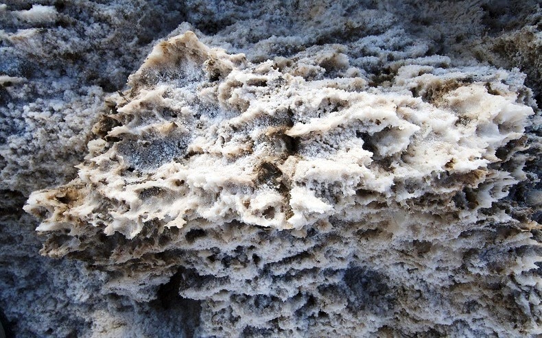
in 1932. The beautiful Rock City contains hundreds of labeled local trees, plants, variety of unique and bizarre rock formations. Legend states that an Indian who loved a woman from a rival tribe was thrown from the mountain when he was discovered. Near Lover's Leap is a beautiful view of the High Falls of Lookout Mountain. The award-winning, light show features over 30 holiday scenes that transform the garden’s natural daytime splendor into a nocturnal fantasyland. Visit with St. Nick and his elves! Enjoy gingerbread cookie decorating, hot cocoa, Sugar Plum Fairy Makeovers and nightly entertainment at the North Pole Adventure! See elves harvesting candy canes and building toys.


Sunday 16 March 2014

Chimney Rock Nebraska United States


The Chimney Rock is one of the most prominent and distinguishable landmarks in Morrill County in western Nebraska in the US. The remnant of the erosion of the bluffs at the edge of the North Platte Valley, the slender spire with a conical base rises nearly 300 feet above the surrounding valley and is visible for many miles from the east along U.S. Route 26. The impressive formation is composed of layers of volcanic ash and Brule clay dating back to the Oligocene Age 23 million to 34 million years ago. It is placed approximately 4 miles south of present-day Bayard in Millard County. The prominent Chimney Rock shot to fame during the middle of the 19th century when emigrants traveling along the Oregon, California and Mormon Trail spotted it on their journeys across Nebraska. Roughly 350,000 settlers passed by Chimney Rock, and hundreds of them mentioned it in their journal entries. Those who followed started to use it as a landmark. Several 19th century travelers stopped to marvel at this natural inquisitiveness and felt compelled to carve their names on Chimney Rock, though very few inscriptions lasted long.
Joshua Pilcher was the first recorded mention of “Chimney Rock”, in 1827 who had journeyed up the Platte River Valley to the Salt Lake rendezvous of the Rocky Mountain fur trappers. In those days the rock was referred to by a diversity of names including Chimney Tower, Chimley Rock, and Elk's Peak, but “Chimney Rock” had become the most frequently used name by the 1840s. The sketches, paintings, written accounts, and some early photos, it is well thought that the spire was approximately 30 feet higher than it is now. Wind, erosion and lightning could have major caused the spire to break off. The severe lightning strike in 1992, the Chimney Rock suffered a 5-foot loss in height all at once. In 1956 the place of Chimney Rock was designated a National Historic Site.Source: Charismatic Planet


The Salt Pan of Devil’s Golf Course Death Valley in California


The Devil's Golf Course is a huge salt pan on the floor of Death Valley, situated in the Mojave Desert in eastern California. Though its particular boundaries are below par defined, and it spreads from the vicinity of the Ashford Mill site to the Salt Creek Hills, a well distance of around 40 miles. The large salt pan is basically a colossal, dried up bed of a lake that once well covered the valley to a depth of about 30 feet. It is believed that nearly 2,000 to 4,000 years ago the lake dried up which have leaving behind dissolved minerals more than thousands of years, were sculpted by weathering processes into eccentric shapes. The salt pan is so amazingly serrated that the 1934 National Park Service guide book to Death Valley National Monument stated that "only the devil could play golf" on its surface. After some time, the salt pan came to be recognized as the Devil's Golf Course. Over 150,000 years ago the contemporary day salt pan was the site of a large, deep lake produced by snow and melting glaciers as far away as the Sierra Nevada. Famous as Lake Manly, this body of water reached depths of 600 feet, and during this dated the majority of the salts that encompass these formations entered the area. At the close of the last Ice Age approximately 10,000 years ago climate change started a period of evaporation drying up this lake. Then for a brief period during the Holocene about 2,000 to 4,000 years ago the climate was again much damper and one more shallow lake shaped primarily from snow melt in the surrounding mountains and the drainage of the Amargosa River. This time the salt pan flooded to a depth of around 30 feet. After than the climate warmed again, and rainfall declined at some extent and the shallow lakes started to dry up. As the water evaporated, minerals dissolved in the lake became increasingly concentrated finally leaving a thick salty pool on the lowest parts of Death Valley's floor. While the saltpan at Badwater periodically floods, then dries, Devil's Golf Course lies in a part of the Death Valley salt pan that is few feet above flood level. Without the smoothing effects of flood waters, the salty salt at Devil's Golf Course grows into bizarre, intricately detailed pinnacles. The pinnacles form when salty water increases up from underlying muds. Capillary action draws the water upward where it rapidly evaporates, leaving a salty residue behind. The pinnacles rise very slowly, possibly as little as an inch in 35 years, and strong wind and rain continually sculpt the salty spires into captivating shapes.Source: Charismatic Planet