Saturday 23 April 2022

Lake Nakuru National Park, Kenya

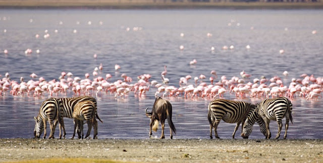
Lake Nakuru National Park encompasses the alkaline lake of the same name and is frequently visited by hundreds of thousands (sometimes more than a million) of greater and lesser flamingos, providing an amazing bird spectacle. More than 400 bird species in all have been recorded. Located 100 miles (160 km) northwest of Nairobi on a fair road, the park covers 73-square-miles (188-km2) — most of which is the lake itself. Nakuru has been declared a black rhino sanctuary and has a fair number of these endangered animals. 

A small population of white rhinos has been reintroduced from South Africa. Other wildlife includes lion, leopard, Rothschild’s giraffe (introduced), waterbuck, reedbuck, hippo, baboon, pelican, and cormorant. The lake is an important stopover for thousands of migratory wading birds that head to and from Europe each year. Lake Bogoria National Reserve, located north of Nakuru, has numerous hot springs and geysers along the lakeshore. 

Thousands of flamingos frequent this alkaline lake, as do greater kudu on the steep slopes of the lake’s eastern and southern shores. Lake Baringo, a freshwater lake located 20 miles (32 km) north of Lake Bogoria, is a haven for a colorful and mixed variety of birdlife (over 400 species recorded). There is a sporting center for waterskiing, fishing, and boating — beware of the hippos and crocodiles!


Friday 22 April 2022

Salar de Uyuni - Bolivia

Bolivia’s Salar de Uyuni defies adequate description, although calling it a blinding, surreal expanse of endless pure-white flatness that must be seen to be believed comes very close. This eerily silent and awe-inspiring Salar (salt flat) is one of the most otherworldly environments on earth, and all that remains of an enormous inland sea that evaporated thousands of years ago. 

Covering an area of about 4,250 sq miles (11,000 sq km), these sun-baked plains hold enormous quantities of salt – 10 billion tons, in fact – and are home to some of the most fantastic wildlife in South America. And for those intrepid travelers who want the full experience, there’s even a hotel here built entirely from blocks of salt. This extraordinary wilderness draws trekkers who are in search of solitude and adventure. 

Most require a 4WD to complete the journey across the flats, which measure 93 miles (150 km), but which often seem ten times that distance because of the daunting emptiness of the place. Sunlight reflects so brightly off the salt that you’re likely to be dazzled for much of the journey. This bright and pristine landscape is interrupted only by one or two rocky “islands” full of cacti, the occasional blood-red flamingo or long-tailed chinchilla, a haunting antique train graveyard, and weird and wonderful mirages that come and go in the distance. 

You might also see the odd miner panning the flats for salt, a centuries-old tradition that is still going strong today. The atmosphere here is considered by many scientists to be the purest on the planet, and the air is so dry and free from variation that the Salar de Uyuni is used as a calibration point for satellites far above the earth. 

Although the traditional end-to-end trekking route can be covered in one day by 4WD, the majority of visitors prefer to span it out over three or four days to make the most of the region’s wonders on their own two feet and at their own pace. Most drive to one of the several trailheads, walk as much of the distance as they wish and arrange for a pick-up a few miles from the other end. 

Watching the sunrise and set, tinting the clouds every color of the rainbow above this immense sheet of white oblivion, is a truly unforgettable experience. While neither the longest nor most arduous trek on the continent, tackling the magnificent Salar de Uyuni, one of the world’s most harsh and arid environments, surely ranks as the strangest of all.


Sunday 17 April 2022

Badlands National Park

The White River BADLANDS could be considered a pocket-sized cousin to Arizona’s Grand Canyon. What’s most impressive about the “Badlandscape” is not its scale, as at the Canyon, but rather its sheer strangeness. More than 35 million years ago this area of southwest South Dakota was a saltwater sea; later it became a marsh, into which sank the remains of such prehistoric mammals as saber-toothed cats and three-toed horses, to be covered with white volcanic ash. 

Drying as it evolved, the terrain became unable to support the deep-rooted shrubs or trees that might have preserved it, and over the last few million years erosion has slowly eaten away layers of sand, silt, ash, mud, and gravel, to reveal rippling gradations of earth tones and pastel colors. The crumbly earth is carved into all manner of shapes: pinnacles, precipices, pyramids, knobs, cones, ridges, gorges, or if you’re feeling poetic, lunar sandcastles and cathedrals. 

While the Sioux cherished these incredible contortions of nature for harboring bighorn sheep, mule, deer, and another tasty prairie fare; early French trappers didn’t share the native's enthusiasm, dubbing these white hills the Mauvaises Terres à Traverser, or “bad lands to travel across;” they have also been brutally described as “hell with the fires out.” 

The most spectacular formations can be found within the Badlands National Park, particularly its northern sector, while the poverty-stricken Pine Ridge Indian Reservation encompasses the southern stretches. Clean-cut Wall, just a few miles north of the park boundaries, is the most–visited commercial center in the region.


Wednesday 13 April 2022

Guiana Highlands Flat-topped mountains disappearing into mist

MYSTERIOUS TABLETOP MOUNTAINS, shrouded with mist and lush with exotic greenery, give the Guiana Highlands the sense of a land time forgotten, tucked into a remote corner of Venezuela. The highlands stretch into the Guianas and sections of Brazil and seem a real-life Jurassic Park, in flora if not fauna. 

Mount Roraima, 8,986 feet (2,739 m) tall and the most impressive of the flat mountains (called tepuis in the native Pemon language), was the inspiration for Sir Arthur Conan Doyle’s The Lost World, a dinosaur-era adventure novel. 

Eroded over millions of years, the sandstone tepuis, called mesas (tables) by the Spanish, are one of South America’s oldest mountain ranges, rising like giant anvil tops above the surrounding landscape of jungle and savanna. It was only in 1935 that sections of the highlands became known to the Western world when American pilot Jimmy Angel discovered the spectacular waterfall now bearing his name, Angel Falls. 

This is the highest waterfall in the world, with a 3,212-foot (979 m) cascade plummeting off of Auyán Tepuí, also called Devil Mountain. The torrent is 17 times the height of Niagara Falls. It is the highlight of Parque Nacional Canaima, one of the largest national parks in the world, the tiny village of Canaima its gateway.


MAVERICKS: THE BIG WAVE

MAVERICKS: THE BIG WAVE - A COLD-BLOODED MONSTER There, off Half Moon Bay, some nineteen miles south of San Francisco, a half-mile offshore from Pillar Point Harbor, what is perhaps the most dreaded wave anywhere on the planet can be seen breaking. This anomaly of nature feeds both the dreams and the nightmares of every top surfer. 

To get an accurate idea of what this place is like, you need to forget all those colorful surf culture clichés, such as palm trees, flower-patterned shirts, white sand, and bikinis. The local beach boys brave the cold water wearing thick black hooded wetsuits. Besides, they don’t have time to strut about on the beach because they have to paddle for three-quarters of an hour, avoiding rocks and strong currents, to reach the lineup. It’s certainly not the beauty of the scenery that warms their hearts—far from it. 

This place has nothing in common with the sumptuous turquoise undercroft of Tahiti’s Teahupoo or the lightness and delicacy of the waves at Bali or Hawaii. Here, the best they can hope for is a mass of murky water launched at full speed, a dark wall climbing without warning to a height of sixty feet, exploding with such power that it can be recorded on the Richter scale. This monster would probably have remained unknown had a young and intrepid local boy not tamed it in the 1970s. A high school student from Princeton-by-the-Sea, Jeff Clark, had developed a passion for the great beast that roared nearby when the winter storms generated enough of a swell to rouse it. 

In 1975, he risked it for the first time, and then a second. Over a period of fifteen years—always alone—he learned the secrets of this atypical wave ignored by the big-wave surfing community, who only had eyes for Hawaii. And then one day Jeff revealed his secret garden to a group of friends, who couldn’t believe their eyes. Photos of Mavericks went all around the world, and the elite of the discipline rushed to Princeton-by-the-Sea. Then disaster struck. In December 1994, Mark Foo, the master of big wave riding from Hawaii, drowned here, knocked out by blows from the wave soon after arriving. 

Mavericks became the cursed wave that would take more lives and cause many more injuries. But it is impossible to avoid: All self-respecting big-wave surfers simply have to pit themselves against it. And so, despite being gripped by fear, they submit to this ultimate surfing challenge that, deep down, nobody wants to take. Giving yourself up to the cold water, getting your bearings as best you can relative to the coast in order to avoid the impact zone, trying not to think about the reefs that just want to break your bones or, even worse, snag the leash of any surfer unlucky enough to be caught in the crusher, thereby condemning him to drown. 

For those unmoved by the prospect of being crushed to death between icy water and jagged rocks, there is more danger to be had. Great white sharks of the North Pacific have a particular predilection for the shallows off Pillar Point.
Thursday 7 April 2022

Pan-American Highway

The world’s longest highway runs from Alaska to Patagonia for almost 28,800 miles (48,000 km). Millions of travel sections of the route, and very few do the whole trip. Daytime TEMPERATURES Arctic lows of -22°F (-30°C) to tropical highs of over 104°F (40°C). 

The Pan-American Highway is so vast that the only way it can be taken in is by a reliable vehicle over a period of several months (some say years). Given the vast expanse of the highway, you’re almost guaranteed to encounter climatic extremes – and everything in between – no matter when you go. However, leaving Alaska anytime between Nov and Mar is never a good idea.

Trying to describe the world’s longest highway is like trying to describe the entire Western American Hemisphere, as that’s exactly what the Pan-American Highway is – a link that travels from the Arctic to the Antarctic. Apart from the notorious Darien Gap, a tantalizing 90-mile (150-km) strip in Panama, you can travel from Alaska’s Prudhoe Bay to the southernmost town in Tierra del Fuego and never leave this mega highway. Literally, almost every ecosystem and habitat on earth is encountered along the way, making this truly the world’s “ultimate road trip.” It is estimated that fewer than 500 people have ever completed the entire grueling journey.


Monday 4 April 2022

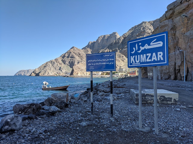
Kumzar - A Beautiful Village in Musandam

Set on an isolated khor at the northern edge of the peninsula, the surprisingly modern town of Kumzar is accessible only by boat. The villagers speak their own language, known as Kumzari – a combination of Farsi, Hindi, English, Portuguese and Arabic. There is nowhere to stay in Kumzar, and there are no sights of special interest in the town. It is nonetheless fascinating to wander around the old stone houses and the souq area to see how this outpost has developed its own unique character. 

Note that officially you are required to have a permit (arranged by pre-booking with a tour company) to enter this or indeed any village in the Musandam khors. Water taxis travel between Khasab and Kumzar, charging an outrageous OR120 (and in excess of OR200 at weekends) for the harrowing trip in a speedboat with no seats and a maximum clearance between deck and gunwale of 15cm. It’s better to organize a day trip through a tour company.