Showing posts with label Scotland. Show all posts

Friday 27 November 2015

Wild Scotland

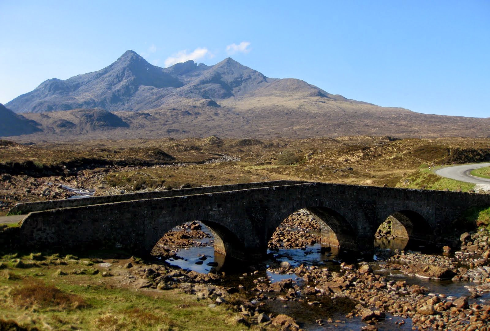
For my second aerial film, entitled ‘Wild Scotland’, I wanted to showcase some of the wilderness this magnificent country has to offer. From the Highlands and Islands on the west coast to John O’Groats and North Berwick on the east I’ve captured just a fraction of the stunning wilderness which Scotland has to offer.

I’ve spent the last few months travelling up and down the country capturing locations, carefully planning my schedule to take advantage of the best light, be that dawn or dusk. Along the way I’ve been lucky to pick up some unexpected shots such as deer near Ardnamurchan and a large group of seals in a bay near John O’ Groats at the very top of the British mainland. I was lucky to experience a prolonged spell of good weather so filming this was a much faster process than for my first aerial film; Beautiful Scotland.

Making this film involved a series of mini adventures. Hiking up Bidein a'Ghlas Thuill at 3am in the pitch dark, to film the spectacular serrated ridge of An Teallach, and hearing stags roaring in the valleys below is a memory that will stay with me for a very long time. Also filming Bass Rock near North Berwick, which is home is to the world’s largest single rock Gannet colony with some 40,000 pairs of birds, at first light was a real treat.
The film was mostly shot on the DJI Inspire 1 and for the more remote locations I used the DJI Phantom 3 which can be packed in a backpack really easily. 

Big shout out to Drew Gibson who has done another magnificent job colour grading this and also to Pete Smith (thesoundspace.co.uk/) who created the sound mix. Cheers also to Rob Waugh (facebook.com/curiousrobinfilms) for feeding back throughout the edit and helping suggest locations.
Locations in order –

An Teallach
Ardnamurchan lighthouse
Bidein A’ Ghlas Thuill
Mangersta Sea Stacks, Isle of Harris
Suilven
Luskentyre Beach, Isle of Harris
Callanish Standing stones, Isle of Lewis
Duncansby Bay (Seal shot)
Tantallon Caslte
Bass Rock
Ardnamurchan
Duncansby sea stacks
Glen Etive
Castle Stalker
Arisaig
Forth Rail Bridge
Neist Point, Isle of Skye
Music again by the fantastic Tony Anderson – Eyes Wide Open

Wild Scotland from John Duncan on Vimeo.

Sunday 18 January 2015

Loch Torridon Scotland


Loch Torridon is also called Loch Thoirbheartan actually a sea loch on the west coast of Scotland in the Northwest Highlands. The stunning loch was created by glacial processes and it is approximately 15 miles long. The loch has two sections, Upper Loch Torridon to landward, east of Rubha na h-Airde Ghlaise, at which point it joins Loch Sheildaig; and the main western section of Loch Torridon proper. Loch a' Chracaich and Loch Beag are small inlets on the southern shores of the outer Loch, which joins the Inner Sound between the headlands of Rubha na Fearna to the south and Red Point to the north. The name Thoirbhearta has a similar root to Tarbert and indicates a place where boats were dragged overland.

Shieldaig Island has been owned by the National Trust for Scotland since 1970. It has coverage of Scots Pine, which may have grown from seeds taken from Speyside in the mid-19th century. Loch Torridon as seen from Torridon village, which lies at the head of the loch and is surrounded by the amazing Torridon Hills. Whereas, to the north are the villages of Redpoint, Diabaig, Wester Alligin and Alligin Shuas. However; on the south is Shieldaig. The view North West from the summit of A Ruadh-stac takes in Beinn Damh, Upper Loch Torridon and Beinn Alligin.

The loch is surrounded by numerous mountains to the north, including Liathach, Beinn Alligin and Beinn Eighe, all of which are over 3,000 feet in height. The Torridon Hills exhibit some of the most beautiful mountain scenery in the British Isles, surpassed in grandeur perhaps only by the Cuillins of Skye. The rocks of which’re made are known as Torridonian sandstone, some of which’re crowned by white Cambrian quartzite. They’re in the midst of the oldest rocks in Britain, and sit on yet older rocks, Lewisian gneiss.

Loch Torridon is a vital prawn and shellfish fishery and is home to numerous salmon farms and industrial mussel production. Langoustines are fished by creels baited with herring or prawns, which are deployed on lines of up to 120 creels and left on the seabed for at least a day. Most of the catch is exported to Spain, but some is sold locally. The sustainable seafood certificate for Loch Torridon langoustines was suspended by the Marine Stewardship Council on 11 January 2011, due to increased fishing pressure in the area caused by creel-fishing boats that had not signed-up to the fishery's voluntary code of conduct.

Friday 28 November 2014

Giant Horse Head Sculptures in Scotland


The giant sculpture is towering 30 meters (approximately 100 feet) above the ground, The Kelpies consists of a pair of mammoth horse head sculptures installed by artist Andy Scott in Falkirk, Scotland. The Scottish artist almost spent a total of 9 years designing and then assembling the sculptures on-site, crafting steel parts into intricate busts that allude to the legendary Scottish water spirit that takes the form of a horse.

The Kelpies project was undergoing construction from long time in The Helix Park, but as these spectacular images taken by photographer dswain display us, the canal site has been transformed entirely to complement the dynamic grace of the sculptures since the installation was opened to the public in April 2014. Moreover; the colorful lights around and inside the steel works illuminate their superlative shapes in the darkness, additionally increasing the beauty of the Scottish landscape.

For artists, the project's location finally decided to in his father's hometown of Falkirk, the cultural tale of kelpies, and Scotland's industrial past compelled him to take on the project as a source of national pride. The Scott determined to build around a contemporary sculptural monument. Water-borne, towering gateways into The Helix, the Forth & Clyde canal and Scotland, translating the legacy of the area into honored equine guardians he say; I see The Kelpies as a personification of local and national equine history, of the lost industries of Scotland. I also visualize them as a symbol of modern Scotland full of pride and royal, of the people and the land. They’re the culmination of cutting edge technology and hand crafted artisanship, formed by our country's leading authorities through international partnerships."

Friday 24 October 2014

Sgurr nan Gillean Scotland


Sgùrr nan Gillean is a 3162 feet (964 m) high mountain in the northern section of the Cuillin range on the Isle of Skye in Scotland, actually one of eleven Munros on the Cuillin ridge. The mountain is close to Sligachan, and its striking triangular profile is perceptible behind the Sligachan hotel, making it perhaps the most recognized peak in the Cuillin range. In November 2013 it was found that Knight's Peak is, in fact, six and a half inches too short to be classified as a Munro Top and is now considered a Corbett Top. Knight's Peak was named after W. Knight, who, with a guide, made the first recorded ascent in 1873.
Well, the most admired route of ascent is the Tourist Route, follows a path leading south from Sligachan, crossing a burn known the Allt Dearg Beag. This route continues up into a corrie, the Coire Rhiabhach. The ascent of the coire headwall is on loose rock and scree. The continuation up the southeast ridge to the summit is exposed, and calls for scrambling skill. The path up is very narrow so calls for single file when a party ascends. The top is a ridge which must be traversed to get to the final summit, and like the climb, requires few scrambling ability. Make sure, all sides are very exposed, and extra care is required if mist descends. The small airy summit platform is astonishingly flat and smooth with splendid views.
The other different route is the north ridge, recognized as Pinnacle Ridge, which is actually a rock climb that needs a climber to have a rope and harness and be skilled of abseiling, unless the third pinnacle is omitted by bypassing on the east side. Though rope is a sensible option for the moderate climb up Gillean, it is not necessary for Knight's Peak if the correct route is taken. So, to reach the base of the Pinnacle Ridge a climber starts in the similar place as for the route defined above but instead of crossing the burn continues up hill on the right hand side until just below the start of the Basteir gorge when the stream exiting the gorge is crossed to reach the base of the lowest pinnacle.
Another alternative route of ascent or descent is the West Ridge. The route leads from the summit down to a bealach separating Sgùrr nan Gillean from Am Basteir. About two-thirds of the way down, there is a particularly narrow and exposed section, which forms the remains of a large upright rock, known as the Gendarme which broke away due to the effects of frost shatter during the winter of 1986/87, leaving only the base. The narrow section can be avoided by abseiling down (or climbing up) a gully, known as Nicholson's Chimney, on the north side of the ridge.

Sunday 22 June 2014

Old Man of Storr in the Isle of Skye


The Old Man of Storr is located on the north of Skye in the area known as ‘Trotternish’. Here’re breathtaking photos of the Old Man of Storr in the Isle of Skye, Scotland There's a reason why this is one of the most snapped landscapes in the world. The Old Man Storr is a remarkable pinnacle of rock on the Ise of Skye in Scotland that's surrounded by fabulous views. Think rocky hills next to striking green grassy slopes and then visions of water beyond. The place is relatively easy walk and the hike to the pinnacle's foot is just 1 mile, especially for such a tremendous experience. Most day-trippers are content simply to meander around the Sanctuary, admiring the pinnacles and gazing up at The Storr's eastern cliffs. But the question is how did the rocky pinnacles form? 

The weight of basalt lava on sedimentary rocks of the earlier Jurassic age is the main reason of massive landslides. The hills are made of horizontal flows of the basaltic lava, built on top of each other. What's it like standing there? "The Isle of Skye is packed of magical places and this might be one of the most magical places for photographers. The pinnacles of rock are far more gigantic than this photograph conveys in low resolution. The full resolution shot reveals a head-high sign on the path and it is totally dwarfed by the Old Man’s gargantuan size. 

Walking between those titans is like living in a fantasy novel or more recently, a sci-fi film - one of the opening scenes from Prometheus was filmed here. It’s quite a place as well. For those of us who have yet to visit, here are some of dramatic photos of famous Old Man of Storr. Love how the otherworldly landscape takes on such a different feel as the seasons change. Hiking on this place is a great activity in Skye if the weather is good enough. The walk to the top is steep, and requires good shoes as it can be boggy in parts, but the view from the top is magnificent, so well worth it. Great walk for the dog however there are wild sheep roaming so keep pooches on a lead. The best sights are from the top of the cliffs to the east of the summit, from which you can look down on the tortured landslide topography where you left the crowds behind you half an hour ago.