Friday 14 February 2014

Moonlight Rainbow Banpo Bridge Seoul South Korea

Banpo Bridge Water Fountain is world’s longest fountain bridge located in downtown Seoul along with Hangan River. This is really a unique bridge which operates both side of bridge and it is more than one kilometer long. The project was launched in 2007, for the purpose of to revive the river area for locals and tourist. It was installed in September 2009, to further beautify the city, and connecting the Secocho and Yongsan districts. The water is directly pumped from river and incessantly recycled. It is first double deck bridge construct in South Korea and given name of “Moonlight Rainbow”. The lovely fountain shoots down 190 tons of water per minute to the river and shoots as far as 43 meters horizontally. In the night the fountain colors transform to that of a rainbow by the 200 lights that radiate several colorful effects. The Moonlight Rainbow Fountain set a Guinness World Record with nearly 10,000 LED nozzles that run along both sides that is 1,140m long.


Paradise in Coron Palwan Philippines

Coron Island Palwan is a wedge-shaped limestone island, and third largest island in the Calamian Islands in Philippines. It is about 170 nautical miles southeast of Manila & some of few its coastal areas being well covered by mangrove forests. The island is popular due to Japanese shipwrecks of World War II vintage. It is the part of large municipality of the same name, as it has almost over 30,000 inhabitants of 6,264 households. The island is consists of seven popular lakes, in which Kayangan Lake is nationally claimed cleanest lake in the Philippines. This area has number of islands with lovely white beaches and crystal clear blue water perfect for snorkeling deep sea, shipwreck diving, and fishing.
The Coron main industry is fishing & tourism and the aquatic scenes from the sunken Japanese warships off Coron Island are listed in Forbes Travelers Magazine top 10 best scuba diving sites in the world. Tourists can enjoy local fruits such as jackfruit, watermelon, mango, and seasonal coconut. For visitors lot of attraction & activities in Coron Philippines like, Mt. Tapyas Trek, Maquinit Hot Spring, Breathtaking Malcapuya Island, Culion, Siete Pecados, Barracuda Lake, Kayangan Lake, Twin Lagoon, CYC Island, Skeleton Wreck, Banol, Coron Horseback Riding, Mountain Biking, and Jungle Treks.


Wednesday 12 February 2014

Superior Lake USA


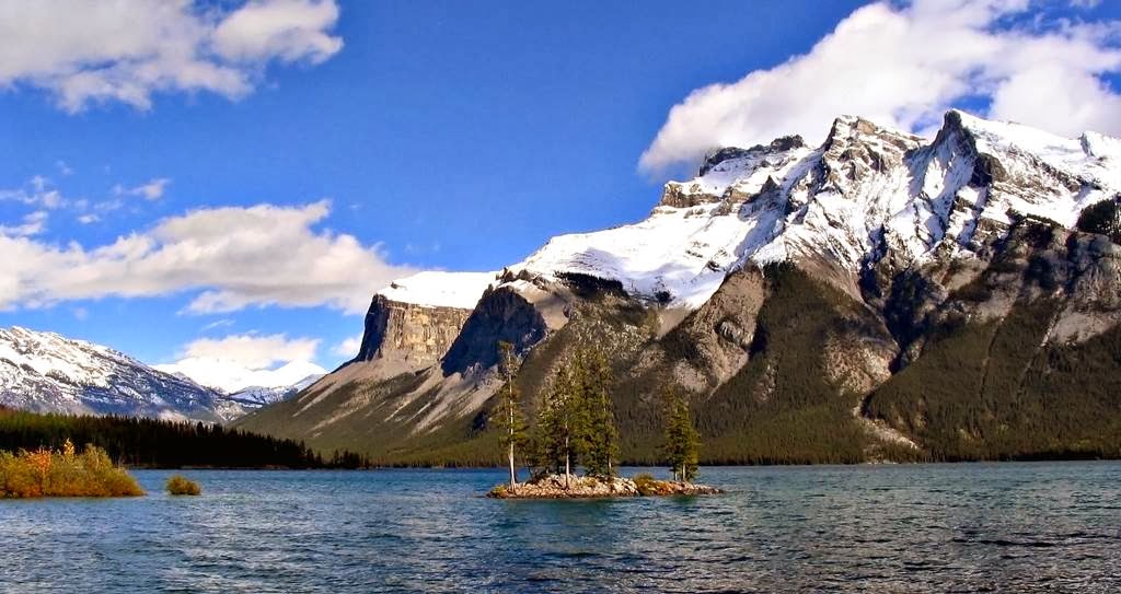
Lake Superior in terms of surface area is largest freshwater lake in the world & third largest freshwater lake by volume in North America. It is considered Great Lakes of North America, which is bounded by Ontario and Minnesota to the North and West and Wisconsin 
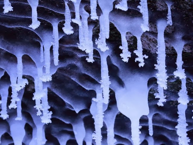
and Michigan to the South. The frozen Lake Superior hasn’t completely frozen over in two decades, and it is predicted that lake will soon be totally covered with ice, especially record breaking cold winter. The beautiful Lake Superior empties into Lake Huron via the St. Marys River and the Soo Locks. Lake Superior shoreline stretches to 4387 Kilometers including islands.
Lake Superior ice thickness varies immensely from a very thin sheet in specific areas near the coast to several feet thick in other spots. On the shoreline of Ontario, you can found world’s oldest rocks, about 2.7 billion years of age. On 30 July 1985, an American limnologist J. Val Klump was the first person to reach the lowest depth of Lake Superior. The temperature of Lake Superior surface varies seasonally, which makes the lakes seasonally stratigraphic. The lovely migrating birds of prey funnel down Lake Superior's north shore in countless numbers each fall, it is estimated on a single day at Duluth's Hawk Ridge as many as 100,000 birds of prey might pass by. Lake Superior normally warming up in June, and start to cold in the end of August. In that time tourist can enjoy 
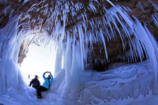
the beauty of this wonderful lake. The record breaking ice on the lake to the extraordinary cold winter recently experienced an all-time record of 23 straight days of below zero temperatures. Lake Superior water level fluctuates from month to month with the highest lake levels in October and November & lowest level in March and April.
It is believed that the first people came to the Lake Superior region 10,000 years ago after the retreat of the glaciers in the last Ice Age. Lake Superior has been an important connection with Great Lakes Waterway, offering a transportation route for several commodities such as iron, grain, other mined and manufactured material. Large vessel transports these commodities across lake Superior. More than 80 different species of fish have been found in Lake Superior, like Brook trout, round whitefish, walleye, Banded killifish, Yellow perch, Cisco, Burbot, Pumpkinseed, etc. In the summer season, the sun sets more than 35 minutes later on the western shore of Lake Superior than at its southeastern edge.

Ice Cave of Lake Superior


The Lake Superior ice caves have not been accessible since 2009, were announced open to the public. The National Park Service hopes the caves will be reachable for about 6 weeks but is completely weather-dependent. The beautifully ice caves are a massive attraction for tourist, and almost 10000 peoples flocked to Meyers Beach (from where the caves are accessible after a 1 mile hike) to observe the unique formation.


Sunday 9 February 2014

Lake Minnewanka Canada

The most beautiful Lake Minnewanka is actually a glacial lake located in the eastern area of Banff National Park in Canada, at least 3.1 miles northeast of the Banff town site. The lake is 28 kilometers long and 466 ft deep, making it the longest lake in the mountain parks of the Canadian Rockies. There’s a power dam at the west end. The lake is fed by the Cascade River, flowing east of Cascade Mountain, and runs south through Stewart Canyon as it empties into the western end of the lake. Numerous streams flowing down from Mount Inglismaldie, Mount Girouard and Mount Peechee on the south side of the lake also feed the lake. Aboriginal people long inhabited areas around Lake Minnewanka, as early as 10,000 years ago, according to stone tools and a Clovis point spearhead discovered by archaeologists. The area is rich in animal life i.e bears, elk, mule deer, mountain sheep, and the easy availability of rock in the mountainous terrain was most important for fashioning weapons for hunting. The western end point of the lake can be reached by following Lake Minnewanka road from the Trans-Canada Highway. Boat tours are easily accessible near the parking lot. A hiking and mountain biking trail runs along the northern shore of the lake, passing Stewart Canyon and six backcountry campsites. Dams were built in 1912 and 1941 to supply the town with hydro-electric power. Lake Minnewanka itself has a popular with recreational SCUBA divers. Lake Minnewanka is actually the largest lake in the park, and really a great place of picnic point.