Wednesday 1 August 2018

Volcanic Crater of Diamond Head Hawaii

Diamond Head is a famous volcanic crater of Hawaii, located on the eastern edge of Waikiki’s coastline. The most recognized landmark is known as Leahi (brow of the tuna) in Hawaiian. The crater was named “Diamond Head” by 19th century British sailors saw calcite crystals sparkling in the sunshine and thought they had found diamonds on the crater's slopes. These "diamonds" were actually shiny calcite crystals that had no value. In 1898, when the United States annexed Hawaii harbor defense became a main responsibility. One of the major defense forts, Fort Ruger, occupied the Diamond Head Crater. This broad, saucer-shaped crater is now a popular tourist place and hiking destination. Around 1.1 km hike leads to the edge of the crater's rim.

Diamond Head Hawaii has once been an active volcano, but hasn't spewed any ashes for more than 150,000 years. Diamond Head Hawaii has steep 99 steps, and a trip through the tunnel leading to them, as you climb the Diamond Head Trail near Waikiki. Further, geologists believe that the commercial diamond deposits were formed in the mantle and delivered to the surface by deep-source volcanic eruptions. These eruptions produce the kimberlite and lamproite pipes that are sought after by diamond prospectors.

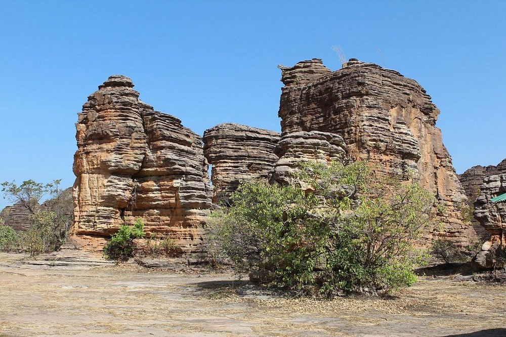
Diamond Head Hawaii crater was formed during a single, explosive eruption that sent ash and fine particles in the air. Once these materials take place, they cemented together into a rock called tuff, creating this massive crater, and which is visible from the trail in the park. Most of the vegetation and birds were introduced in the late 1800s to early 1900s. The crater is 3,520 feet in diameter with a 760-foot summit. The volcano is a symbol of the worldwide recognition of the Hawaiian Islands. Many souvenirs from Hawaii and surf shop logos around the world bear the volcano's distinctive silhouette.

Because of its unique geological history, Diamond Head was declared a National Natural Landmark in 1968. Moreover, in the early of 19th century an observation deck was constructed at the summit to provide target sighting and a four level underground complex was built within the walls of the crater as a command post. A 580-foot tunnel was dug through the crater wall to provide easier access to the Fort. A battery of canons was located within the crater providing complete concealment and protection from invading enemies.

The observation deck and underground complex is now abandoned with the advent of radar but evidence of the command post is still present along Diamond Head Trail. A 1975 televised game show, The Diamond Head Game was set at Diamond Head. Diamond Head is an extinct volcano and one of the most photographed attractions in Oahu. In fact, it is a worldwide symbol of Hawaii and Waikiki, made popular in many movies, wall calendars and on postcards.
 Diamond Head Volcanic Crater hike takes 1.5 to 2 hours round-trip, and suggested that hikers bring adequate water, sunscreen and a hat. Although it is not very difficult, but never underestimate as hike is not a casual one. The mostly unpaved trail winds over uneven rock, ascends 74 steps, then through a tunnel and up another steep 99 steps. Further, the there is a small lighted tunnel to a narrow spiral staircase about 30 steps inside a coastal artillery observation platform built in 1908. From the summit above the observation platform both Waikiki and the Pacific Ocean can be seen in detail. Hence, if you want to hike at Diamond Head then it is highly recommended to come early to avoid the crowds and hot temperatures.


Tuesday 31 July 2018

The Doomsday Bunkers of South Dakota


No one can sense unforeseeable future. The nuclear war or biological warfare destroyed human being. The catastrophic war can killed most living beings and wipe out earth with radioactive fallout. Hence, in South Dakota, about 8 miles south of the town of Edgemont United States plan to save a small population of 5000 human beings in a remote underground shelter would be one of the few surviving pockets of civilization scattered throughout America. These Doomsday Bunkers are equipped with protection against everything from bombs to bio-hazards. The company's latest offering, the XPoint, is advertised as the largest 'prepper' community on Earth.

The plan is proposed by California based survival company Vivos. Few years back the company acquired 18 square miles complex called Black Hills Ordance Depot. Which is completely retrofitted with full amenities like an internal power generation system, deep water wells, biological, chemical and radiation air filtration systems, sewage discharge, and critical support equipment?

The Doomsday Bunker Design contains over five hundred nuclear-hardened concrete military bunkers, to some extent buried underground and protected by thick berms of earth, to resist a surface blast wave, as well as radioactive fallout. This area is strategically and centrally located in one of the safest areas of North America, at a high and dry altitude of 3,800+/- feet, well inland from all large bodies of water, and 100+/- miles from the nearest known military nuclear targets,” Vivos says on their website. Instead of windows, LEDs are placed inside the bunkers to simulate the different views of the outside world.

Therefore, every bunker is accomplished of withstanding a 500,000-pound internal blast. Each bunker is 26ft wide and 80ft long and can accommodate 10 to 20 people and the needed supplies for a year or more. The bunkers are separated from each other by an average of 400 feet in all directions that will work in their favor by providing security, protection and privacy. The Black Hills Ordnance Depot (BHOD) was constructed in 1942 and originally functioned as munitions storage facility during the Second World War and the Cold War period.

The survival bunkers were called Igloos because of their characteristic shape. The complex was once spread over 33 square miles and contained over 800 igloos and all the amenities of a well-planned town including living quarters for over 1,000 people, an Army hospital, a post office, church, shopping center, movie theater, including a theater, swimming pool, bowling alley and other mainstays of a small American town.

The survival bunkers igloos held all types of ammunition including chemical weapons and the deadly sarin and mustard gas. The history of World War II reveals, the site also held Italian prisoners of war. After the serving its object, the facility was closed in 1967. These bunkers were used by the Army in 1942 and built with reinforced concrete to withstand a 500,000-ton blast. Peoples can now lease the bunkers to be used as shelters in the wake of a disastrous event.
In case of any nuclear war, a viral pandemic or an asteroid strike at one-time upfront payment of $25,000 per bunker, plus a 99-year lease of $1,000 per year. Moreover, shared bunkers are also available at $7,500 per person. Aside from the facility at South Dakota, Vivos also has shelters in the state of Indiana in a Cold War era bunker adept of accommodating about eighty people. Moreover, Vivos is also building a luxury private shelter in an underground complex in Rothenstein, Germany. Source: Charismatic Planet


The Ultimate Natural Domes of Fabedougou


The amazing weathered rocks in the village of Fabedougou, near Banfora, in south-western Burkina. Faso Domes have an entirely different origin. Burkina Faso is a landlocked country in West Africa, covers an area of 274,200 square kilometers and its capital is Ouagadougou. The African country village Fabedougou has around 1,000 populations. The Natural Domes of Fabedougou very closely resemble to the famous sandstone towers of Bungle Bungle Range in Australia, hardly half a million years old.

The Domes de Fabedougou is a natural phenomenon of rock sculpted by wind and erosion like a stack of pancakes.  The sandstones comprising the Domes of Fabedougou are approximately two billion years old or Middle Proterozoic. But not the Domes of Fabedougou. Generally, a two billion year old rock would have been metamorphosed by the severe heat and pressure generated by the dynamic nature of the Earth’s crust.

In spite of being very old, these sandstones have been hardly metamorphosed and are astonishingly young looking. Keeping the time in mind, it is surprising that they are so well-preserved that some of these rocks even have ripples and dunes created by ancient water and wind flow. Tese Domes are actually ancient sand dunes. Geological experts say this entire area was once under a big ocean packed with free-flowing sediments. Some layers are extremely hard to others, so they were more protected from erosion.               

Therefore, as the time passes, that the sediments settled down and compacted to form sedimentary rocks of different thickness. Although, going pass a process of weathering and fracturing these rocks were molded into domes and craggy fingers pointing skyward. Differential weathering gives the rocks their layered looked, with each layer weathering at a different rate depending upon their composition.

The magnificent hauntingly beautiful Domes de Fabedougou undisturbed, and better for their desolation, bar local cows and herders. They are there for the climbing, and there are some easy ascents up the cracked sides of the domes, which sit side by side like a series of enormous urey iuloos.


Sliding Glass Rock, A Refreshing Area For Sliding Lovers


In North Carolina, near Brevard a sliding rock waterfall attracted thousands of visitors to take a slide all the way down the waterfall into plunge pool. Sliding Rock is a small slide type waterfall on looking glass creek. Sliding Glass Rock has a gentle slope of 60 ft long ending in an 8’ big deep pool at the bottom. On average, 11,000 gallons of water per minute power this natural wonder. People and families have been coming to Sliding Rock NC for some summertime water fun in the Blue Ridge Mountains. 

Sliding Glass Rock is one of most visited place in Pisgah National Forest. The crystal clear water is very cold but refreshing and popular for cooling off in the summer. The Sliding Glass Rock has long been used as a natural water slide for adventurous lovers. The two fun viewing platforms steps down to the pool and railing to support climb the rocks on the left side before sliding down. Tourists are allowed to take sliding down in a sitting position only. This is a heavily used recreation area which often fills to capacity. The best time to come in early in order to avoid rush which take place 12noon till 4pm.

No floatation devices like tubes, floaties or noodles are allowed. Only life jackets are permitted. The Sliding Glass Rock recreation area may close due to heavy rainfall, lighting is detected, and higher water levels. The area has been developed by the United States Forest Service into a famous recreation area. Moreover, parking is well available in a large lot above the rock and beside U.S. Highway 276. A restroom and changing room facility is available and a lifeguard is periodically on duty especially during summer weekends. You can slide during offseason times, but the water is colder than usual and there are no lifeguards or staff on duty.
In case if you are afraid of sliding down then there are a number of observation areas and decks with benches and seats, where you can relax and watch people sliding.  Because watching the children and people having a nice time to a great way to relax. If Sliding Rock is too busy, then it is recommended to take a quick drive over to Looking Glass Falls, which has a large swimmable basin at the bottom. Source: Charismatic Planet


Monday 23 July 2018

Ghaziser Lake on the Route to Babuser Top, Pakistan

Ghaziser Lake is a wonderful Point comes on the way to Babuser Top. Its a majestic lush green outfield and waterflowing in their own paths. Its a Stunning point to stay a while and enjoy the sheer beauty of Nature. The surrounding area is also covered with lush green trees and high mountains. You have put some extra efforts to get in down. The greenish patches are most integral part of this lake. Moreover, in July you can see pink flowers are bloomings in some part of this area, which are added more natural beauty. So, i would recommend to stay here and relish your time with your family and friends. Also, photographers can take some amazing snaps here. At this point, you will have no crowd and eating items. So be careful to have all stuff with you.

Wednesday 4 July 2018

Trovants Stones of Romania


Trovants couldn’t believe they are real. The mysterious living stones of Romania grow, when it rains and move from one place to another without any support. The Stones of Costesti (a small village) in Romania known as Trovants. These are type of sandstone concretion that secrete cement and can at times appear to grow as if alive. These Trovants are amazing geological phenomena consisting of stone core with an outer shell of sand. The local people have different thought and claims; these are growing stones after heavy rain, Trovants tend to appear with smooth and edgeless shapes, cylindrical, nodular, and spherical.
They’ve strong believed that these are type of sandstone concretion that secrete cement and can appear to grow at times, as if they are alive. These are majestic growing rocks seems identical look to sliding rocks of Death Valley. Trovants stones have puzzled experts ever since their discovery. No one can say with definite how these stones grow, and move. The perfect spherical shaped Trovants which sometimes can be found are believed to be because of great magnitudes and durations of the paleoearthquakes.
Trovants are Amazing Geological Phenomena When Mysterious Living Stones Move and Grow?
Trovants is a synonym of German term “Sandsteinkonkretionen”, which means Cemented Sand. In fact these are mesmerizing living stones when cut had spherical and ellipsoidal rings alike to the ones of tree trunk. There are numerous theories on Trovants stones, as scientists are baffled by the phenomenon and some explaining the origin and strange behavior of Trovants. There were few studies about origin of these growing stones of Romania, and there are several hypotheses, some of them even fantastical. Trovants were improperly considered as “sandstone concretions”.
It was found that there was no mineralogical difference between these pseudoconcretions and the surrounding sands, with no different nucleus inside them, and their cement is every so often carbonate-type. Scientists have observed odd rings which resemble those of the trees. And just like it is with the trees, the stone rings reveal the age of Trovants. That’s why many believe Trovants are an inorganic form of life.
The Trovants of Romania signify diagenetic textures shiny paleodynamic conditions and correspond to precise compactions of the sandy sediments holding locally solutions accumulated in the sand. Therefore, during important seismic shocks and under the influence of the internal cohesion forces tended to spherical forms. Also, the gravitation force, seismic shocks, solution cohesion forces and the adhesion strength between the sand grains and the liquid are believed to be involved in this process. The hypothesis on the seismic origin of the Trovants is very well sustained by several laboratory experiments. According to the International Geological Congress conducted in Oslo 2008, “Trovanti” were improperly considered as “sandstone concretions”.
There are various Trovants in Romania which are even diversely shaped. As far as the growth of these “living stones” is concerned, certain stones may gradually get slightly larger as the result of absorbing water, in this case, the accumulations and deposits of minerals cemented by waters rich in calcium carbonate seems to be the reason. Moreover, there was a sedimentation basin in this area some six million years ago, and the Trovants were not identical and complex aggregates of two ore more Trovants can every so often be found.
Trovants stone are unusually tough to break or smash. Generally, no one touches them, so they have the chance to grow from little pebbles to enormous megaliths. There is a museum in Romania, in which the fascinating stones are on display and sold as souvenirs. Even you can plant a Trovants in your garden and wait for it to grow. The biggest Trovants grow to more than 10 meters in height.
The growth of Trovants stones in Romania is believed to happen when a chemical reaction sets in between the layers of deposits and the mineral carbonates in the presence of rain water.  Hence, due to interesting ‘living rocks’ that seem to grow, the site became a good tourist attraction for Romania. To protect these unusual geological creations, the “Muzeul Trovantilor” or Trovants Museum Natural Reserve is now protected by UNESCO. Furthermore “Living stones” can also be found in Russia. A huge round stones periodically pop up from the ground and start to grow in the fields of Andreevka. So, if you ever go to Romania then you must have a stop at Costesti and explore the fascinating mysterious formations that continue to amaze both Scientists and tourists alike.