Friday 24 February 2017

Big Stone River, Russia


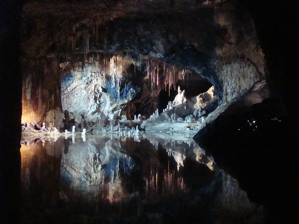
The “Big Stone River” is a chaotic jumble of massive boulders flowing down the slope of the Taganay Mountains in the Southern Urals, on the territory of Chelyabinsk Oblast, Russia. The big river of stone is 6 kilometers long and averages 200 meters in width and 700 meters wide. The enormous rock slide is thought to have formed during the last glaciation more than 10,000 years ago. Therefore, at that time, glaciers were well covered the top of the ridges of the Taganay mountains reaching almost heights up to 4,800 meters. Hence, under the gigantic weight of this ice, the top of the mountain was pulverized into masses of large boulders. Moreover, when the ice melted away, these rocks slowly slide down the hill making the Big Stone River. The geological feature is named “river” only because it look like as such, not because it really flows. Though, the rock slide has been sitting motionless for thousands of years, as the river is occupied by big blocks of quartzite an extremely compact and hard rock consisting of quartz including aventurine. This is a form of quartz containing mica or iron compounds that provides it a shimmering or glistening effect, weighing up to 9 to 10 tons each. The layer of rocks goes down 6 meters deep.

More interestingly, as one reaching the Big Stone River, the crisp sound of running water can be heard. The sound is created by small streams running under the rocks. Therefore, the Big Stone River is not the only stone river on earth though. Alike rivers of stone are found in other regions of the Ural Mountains. Outside of Russia, numerous stone rivers can be found in the Vitosha Mountain, in Bulgaria. One of the largest extends over 2 km in length is located on the Subalpine plateaus at the Zlatnite Mostove (‘Golden Bridges’) site in the upper course of Vladayska River. One more stone river in Vitoshka Bistritsa River valley is up to 300 m wide, and other stone run formations sprawl even wider on the mountain slopes.


Tuesday 21 February 2017

The Saalfeld Fairy Grottoes, The Nature Best Piece on Earth


This is most enchanting place on earth, as there is no painter in the world as talented and skilled as nature, the magnificent burst of colors in these underground caves is maybe one of nature’s best pieces. The Saalfeld Fairy Grottoes are caverns or grottoes of a former mine near Saalfeld, in the German state of Thuringia. The Saalfeld Fairy Grottoes are famous for their myriad colorful mineral formations formed quite a lot of years by water dripping via soft rock. It is considered most colorful cave grottoes in the world. This Saalfeld Fairy Grottoes draws an average of more than 160,000 visitors annually. On 22 December 1913, scientists discovered the most beautiful part of the Saalfeld Fairy Grottoes, namely the Fairytale Dome stands with its awe-inspiring, sublime, illustrious in untouched purity and glory," writes Hermann Meyer, one of the discoverers.

The caverns comprise of three chambers connected by galleries. The first chamber presented the history of the alum shale mine opened for sightseeing in 1914. Historically, alum slate was used in a range of medicinal products, as a food preservative and in clarifying water. The historical background of this chamber about environmental radiation treatments formerly offered there until such treatments were found to be hazardous. The 2nd chamber is the source of mineral laden water formed colorful stalagmites, stalactites and other shapes more than the centuries. However, 3rd chamber comprises the famed “Fairy Kingdom” featuring a variegated grouping of deposits that, illuminated by theatrical lights and reflected in a perfectly still pool of water, is thought to resemble miniature castles and other buildings. It is known as “Feengrotten” in German, are in the Guinness Book of Records as the world’s most colourful cave, the most popular tourist attractions in the Thuringia, serve as a striking reminder of medieval mining.

The underground tour is breathtaking, reveals fascinating insights, the minerals they contains and thelives and labour of miners. There's so much to see, including a mineral magnifier, treasures of the mountain and giant scorpions. You can also grow your own stalactites and set molecules in motion, or piece together the minerals of the fairy grottoes and trace 440 million years of history in the panorama grotto cinema. This is a place of discovery for visitors young and old!


Sunday 19 February 2017

The Waffle Rock: A big attraction at Jennings Randolph Lake.

A large piece of rock is display in just outside the visitor center of Jennings Randolph Lake, in Mineral County, in the US state of West Virginia. The one side of the rock appears a usual waffle-like geometric pattern of raised, darker stone that runs in almost completely straight lines across the rock’s surface. The lines cross themselves at different angles forming deep pockets of lighter colored material. This strange formation has caused many to speculate on what might have caused such a strange pattern. The boulder lodged into the ground at Jennings Randolph Lake is a small piece of this rock that is believed to have broken off from the parent outcrop somewhere higher up the slope. A smaller piece of the same rock is also on display in the Smithsonian Institute of Natural History located in Washington, DC.

The bizarre patterning on the so-called “Waffle Rock” is a result of natural erosion, though over the years several alternative theories regarding its origins have evolved, and these engross pretty much the usual aliens, enormous reptiles and ancient Indian societies. The U.S. Corps of Engineers propose some insight into the rock’s formation.  The sandstone layers that make up the rock were formerly deposited about 250 to 300 million years ago. Then as the continent started to breakup by tectonic plate shifts, about 200 million years ago, the sandstone block was folded onto itself frequently creating cracks in the sandstone. Therefore, another 100 million years, the cracks started to fill with iron oxide, leached from the surrounding rock by the percolating water.


However, this iron oxide mixed with the sand grains in the cracks and formed a super hard material resistant to weathering compared to the surrounding sandstone pieces. Hence, the sandstone rock eroded away, it left behind the hard iron-oxide waffle like pattern on the rock. Moreover, the Waffle Rock formation is not regular, although alike patterned boulder have been found in Monongahela, Pennsylvania, and at Tea Creek Mountain in Pocahontas County, West Virginia. Numerous other undocumented examples of this stone patterning are in quite a few other places around the world. Still there’re so many peoples who refuse to accept that the Waffle Rock is a natural formation.  Hell, there are still people who think the Earth is flat perhaps we should bow to his superior knowledge on the subject. Now standing as an attraction for the public to view in person, the Waffle Rock boulder of West Virginia continues to draw the crowds to this truly ancient artifact. 


Friday 17 February 2017

The Bungle Bungle Rane in Australia


The Bungle Bungle Range, in Purnululu National Park, is one of the most attractive geological landmarks in Western Australia. The Bungle Bungle range features unique beehive-shaped sandstone towers and conglomerates alternately striped in black and orange bands. The Bungle Bungle Range formation occupies an area of nearly 450 square kilometers. The Bungle Bungle Range is a spectacularly incised landscape was not really discovered as a travel destination until the mid-1800s. The researchers believed that the sedimentary rocks of Bungle Bungle were formed in the Ord Basin 350 million years ago, when active faults were altering the landscape. The stunning rocks rises up to 578 metres above sea level, and stand 200 to 300 metres above a woodland and grass-covered plain, with steep cliffs on the western face. If you’re flying over Bungle Bungle range, it is a striking sight. Moreover, the area was traditionally occupied by Karjaganujaru peoples; they’re living here for more than 20,000 years, having strong affiliation to this ancient landscape.

The joint effects of wind from the Tanami Desert and rainfall over millions of years shaped the domes. Although the formation appears solid, the sandstone is very brittle. The weight of overlying rock holds the sand grains in place, but when this is removed, the sandstones are without difficulty eroded. The rounded tops imitate this lack of internal strength. Moreover, the water flowing over the surface will exploit the softness and irregularities in the rock, such as cracks or joints, and swiftly erodes the narrow channels that separate the towers. Cyanobacteria can't grow here and without the protective coat the surface is exposed to "rusting". Thus, one of the most prominent features of the sandstones is the alternating black and orange or grey banding. However, the darker bands comprises of permeable layers of rock, which let water to move through with ease. As the water keeps the rock surface moist letting dark algae to grow on them. Hence, the less permeable layers in between are well covered with a patina of iron and manganese staining, producing the orange bands. These outer coatings support to keep the lower parts of the towers from erosion.

Furthermore, a 7 km diameter circular topographic feature is clearly visible on satellite images of the Bungle Bungle Range. It is supposed that this feature is the eroded leftover of a very early meteorite impact crater that maybe hit the area somewhere 250 million years ago. This beautiful structure is well known as the Piccaninny impact crater. The range remained largely unidentified except by local Aborigines and stockmen until 1982 when film-makers arrived in this area and produced a documentary about the Kimberley. The area was gazetted as a National Park in 1987 and was also inscribed as a World Heritage area in 2003.


Lena’s Stone Forest in Russia


Lena’s Stone Forest, is also called Lena's Pillars, actually a natural rock formation about 60 km upriver from Yakutsk, in Russia. Lens’s Pillars are amazing stone structures towers over 150 meters in height and extends along the river for about 80km. This magical place has captivated travelers since the 17th century, however getting there is a real challenge.  Lena Stone forest contains exceptional evidences of the Earth and its living population development history. Plentiful fossils of ancient organisms found here are exclusive preserved evidences of a very significant stage in the history of the organic world and a biodiversity "boom” that occurred in lower Cambrian epoch. This exclusive ecological and tourism location was submitted as a World Heritage site in 2006. Moreover, in Lena Pillars area the fossils of mammoth fauna representatives were found: mammoth (Mammulhus primigenius Blum), bison (Bison priscus Boj), fleecy rhinoceros (Coelodonta antiguibatis Blum), Lena horse (Eggus lenensis Russ), Reindeer (Rangifer tarandus L) and ancient organisms like mollusks, shells, sponges, and trilobites, dating back to the Cambrian Explosion were also found beautifully preserved.
These isolated, towering pillars can reach more than 100 meters in height. The pillars’ rocks formed in Cambrian sea basins more than 500 million years ago and are made up of alternating layers of limestone, marlstone, dolomite, and slate. This areas severe climate and the humidity from the river create risky temperature swings, from +40 °C in the summer to -60 °C in winter. Therefore, this has caused a cryogenic process, containing of a freeze-thaw action that shatters the rock, widening the gullies between them.
The journey starts from Moscow city from where you will have to take a four day journey to the Siberian area of Yakutsk. First, you have to take a flight to Yakutsk, so long that if you flew opposite direction you could easily come to New York. The average price for such flight costs around $800. From Yakutsk you have to take a boat. However, supposedly only a half a day’s trip upriver, it takes considerably longer and the locals can offer you a three day trip on a small boat for about $500. Eventually after 4 days of travel, you’ll be able to have arrived at your destination.


Thursday 16 February 2017

Seattle Floating Bridge


An unusual concept of bridge of concrete and steel that floats may seem highly uncommon, if not impossible, but there’re 20 such bridges around the world, 5 in the U.S. state of Washington alone, of which 4 are the longest floating bridges in the world. Floating bridges, also recognized as pontoon bridges, are generally temporary structures built out of wood during times of emergencies such as war. Wooden floats and sometimes boats are lashed together and flat planks are laid over creating a roadway, letting men and materials to cross bodies of water. Although Pontoon bridges have been used to great benefit in numerous battles throughout history, including the 2nd World War and during the Iran–Iraq War. Therefore, the longest enduring floating bridge, Evergreen Point, usually called the SR 520 Bridge, lies across Lake Washington, in Seattle. In fact it carries the traffic of State Route 520 and is 4,750 meters long. The Lacey V. Murrow Memorial Bridge, the 2nd longest bridge in the world, lies across the same lake just a few miles to the south, and is 2,020 meters long.

Thus, the question comes in mind why floating bridges? The answer lies in Lake Washington’s complex geographical location. Because, the lake bed is too soft for piers of a conventional bridge! However, the other alternative, is a suspension bridge, may fulfill bridge towers the height of Seattle’s Space Needle, which would have been too costly. The concept of a floating bridge across Lake Washington was first suggested by engineer Homer Hadley in the 1930s. Hadley had worked for a firm designing concrete barges during World War I and he recommended the idea of linking hollow concrete barges end-to-end to Lacey V. Murrow, the state's then director of highways. Thus, Hadley’s floating bridge was such a big accomplishment that Washington State adopted the concept for future bridges. However, the 2nd bridge, Evergreen Point, the longest in the world, was opened in 1963. In the honor of a man who first led the concept, the third bridge was named after Homer Hadley. Nowadays, Lake Washington is home to three and all rank among the five longest floating bridges in the world.


Thursday 9 February 2017

The Mysterious Stone Structure of Amazon Rainforest


Researchers has found hundreds of mysterious structures built into the Earth more than two thousand years ago have been discovered in the Amazon rainforest. The truly incredible earthworks have long remained hidden by trees however; deforestation in recent years has discovered over 450 massive geoglyphs. Though, the purpose of stone structure is not known, but believed ditched enclosures were perhaps used sporadically as ritual gathering places. These ditches resemble to Stonehenge approximately 13,000 square kilometers in the western Brazilian Amazon, thought untouched as previously believed.

The real phenomena lay hidden for many centuries underneath mature rainforest actually challenges the idea that Amazonian forests are pristine ecosystem. The region actually forested when the geoglyphs were built, or people impacted the landscape to build these earthworks. Therefore, the researchers reconstructed 6,000 years of vegetation and fire history around two of the geoglyph sites, enlightening heavy alterations by ancient humans. The history tells that humans altered the bamboo forests for millennia, creating small, temporary clearings to build these mysterious structures. The analyzed “phytoliths” a type of microscopic plant fossil made of silica.

So, this allowed them to rebuild the ancient vegetation and charcoal quantities, assess the amount of forest burning and carbon stable isotopes, and determine how ‘open’ the vegetation used to be. Moreover, the search exposed that the indigenous people didn’t burn large tracts of forest, whether for geoglyph construction or agricultural practices. In its place, they concentrated on economically valuable tree species, such as palms, transforming their environment in the process to make a “prehistoric supermarket.” Thus, the biodiversity of few Acre’s remaining forests may have roots in these ancient ‘agroforestry’ practices, the researchers say.

So, hence the findings will be published in the Proceedings of the National Academy of Sciences. Regardless of the massive number and bulk of geoglyph sites in the region, it can certain that Acre’s forests were never cleared as broadly, or for as long, as they have been in recent years. The current evidence that Amazonian forests have been managed by indigenous peoples long before European contact should not be cited as justification for the destructive, unmaintainable land-use practiced today. Moreover it should in its place serve to highlight the ingenuity of past subsistence regimes that did not lead to forest degradation, and the importance of indigenous knowledge for finding more sustainable land-use alternatives.