Monday 19 January 2015

Marmore Falls, Tallest Man-Made Waterfall in Italy


The 
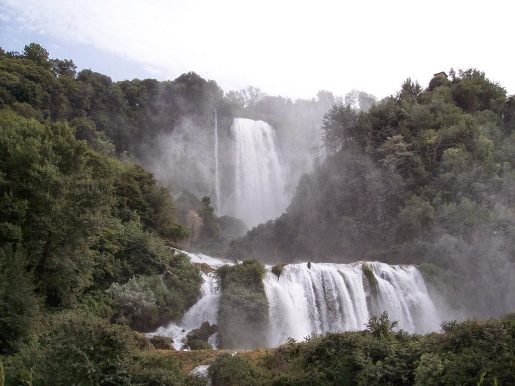
gorgeous marmore’s falls (Cascata delle Marmore) is actually a tallest man-made waterfall in Italy. It is created by the ancient romans, can be found 7.7 kilometers from Terni, a provincial capital of the Italian region of Umbria. The fall total height is 541 feet making it one of the tallest in Italy and in Europe as well. Of its three sections, the top section is 272 feet. The waterfall source is a portion of the waters of the river Velino however, the rest of the river flows into a hydroelectric power plant, after flowing through Piediluco Lake near the community of Marmore.
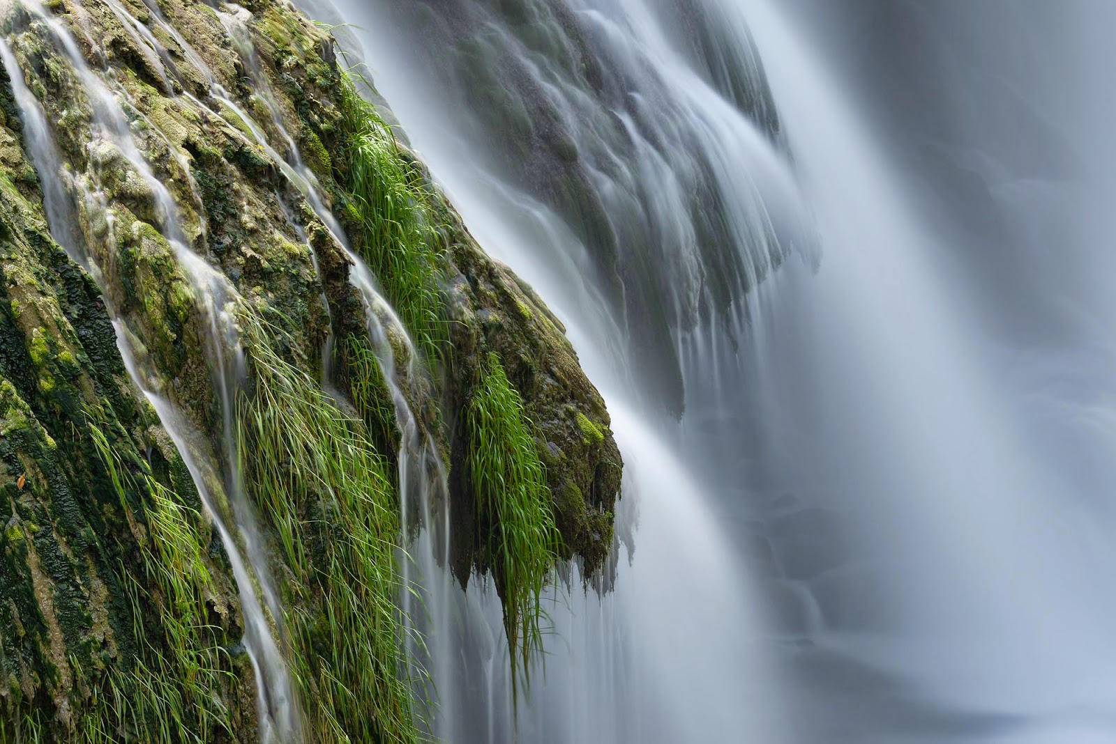
It pours into the valley below formed by the river Nera. Its flow is turned on and off according to a published schedule, to satisfy the requirements of sightseers and the power company equally. Travelers try to be there the moment the gates are opened to see the powerful rush of water. Moreover, most of the time, the water in the canals above the falls is sidetracked to a hydroelectric power plant; hence the flow in the falls themselves is reduced to the level of a creek. Piediluco Lake, above the falls, is used as a reservoir for the power plant.

The Galleto power plant, well built in 1929, is architecturally interesting. Its maximum capacity is around 530 MW. Therefore to control the operation of the power plant, and to satisfy visitors, the fall is turned on according to a set schedule, attaining a remarkable effect at full flow. Moreover there’s an alarm is sounded first, then the gates are opened, and in a few minutes the small creek is transformed into a full-sized river rushing into the void below.

Usually, the waterfall is turned on between 12:00 and 1:00 PM and again between 4:00 and 5:00 PM every day, with extra times on holidays. Make sure, an entrance fee is charged to visit the falls and the surrounding area. A beautiful path along the falls let visitors to hike up to the top of falls. Along the way, a tunnel leads to an observatory just next to the falls, where a tourist is guaranteed to get soaked. A safer observatory near the top affords a grandiose view of the falls and of the Nera valley below.

In ancient times, Velino river flows through the surround of highland of city of Rieti. It fed a wetland that was thought to bring illness, perhaps from Malaria. To risk free the city of Reiti in 271 BC, there’s a plan to construct a canal to divert the stagnant waters into the natural cliff at Marmore. This option generated a different problem to City of Terni, when flood water of Velino River flowed and threatening its inhabitants. However with the passage of time, the poor maintenance in the canal resulted in a decrease in the flow, until eventually the wetland started to reappear.

In 1422, a new canal was planned to construct to restore the original flow. However, the presence of canal creating lot of problems over next two centuries, and then in 1787, it modify to leaps below the falls, and giving the falls its present look and finally resolving the major of the issues. Moreover please be noted, that large and free car parks available both at Upper and Lower Belvedere. It is very imperative, you should check the opening hours of water released before arranging the visit. A lot of children facilities available there, along with suitable family activities i.e. cave visit, night visits, botanical visits, and much more.

If you’re requiring more adventure, then there’re rafting, canoeing and canyoning opportunities, soft Rafting, open to all, including children and non-swimmers; Hydrospeed-soft, surrounded by nature, in full contact with the river and helped by a “bob water” you can go down the soft stretch of the Black River in thorough safety, at all times accompanied by a guide; Tubing-soft, another fun way to get down the stretch soft, slightly above the water level and self-reliantly supported by a guide that explains the trajectories. Charismatic Planet

Sunday 18 January 2015

Loch Torridon Scotland


Loch Torridon is also called Loch Thoirbheartan actually a sea loch on the west coast of Scotland in the Northwest Highlands. The stunning loch was created by glacial processes and it is approximately 15 miles long. The loch has two sections, Upper Loch Torridon to landward, east of Rubha na h-Airde Ghlaise, at which point it joins Loch Sheildaig; and the main western section of Loch Torridon proper. Loch a' Chracaich and Loch Beag are small inlets on the southern shores of the outer Loch, which joins the Inner Sound between the headlands of Rubha na Fearna to the south and Red Point to the north. The name Thoirbhearta has a similar root to Tarbert and indicates a place where boats were dragged overland.

Shieldaig Island has been owned by the National Trust for Scotland since 1970. It has coverage of Scots Pine, which may have grown from seeds taken from Speyside in the mid-19th century. Loch Torridon as seen from Torridon village, which lies at the head of the loch and is surrounded by the amazing Torridon Hills. Whereas, to the north are the villages of Redpoint, Diabaig, Wester Alligin and Alligin Shuas. However; on the south is Shieldaig. The view North West from the summit of A Ruadh-stac takes in Beinn Damh, Upper Loch Torridon and Beinn Alligin.

The loch is surrounded by numerous mountains to the north, including Liathach, Beinn Alligin and Beinn Eighe, all of which are over 3,000 feet in height. The Torridon Hills exhibit some of the most beautiful mountain scenery in the British Isles, surpassed in grandeur perhaps only by the Cuillins of Skye. The rocks of which’re made are known as Torridonian sandstone, some of which’re crowned by white Cambrian quartzite. They’re in the midst of the oldest rocks in Britain, and sit on yet older rocks, Lewisian gneiss.

Loch Torridon is a vital prawn and shellfish fishery and is home to numerous salmon farms and industrial mussel production. Langoustines are fished by creels baited with herring or prawns, which are deployed on lines of up to 120 creels and left on the seabed for at least a day. Most of the catch is exported to Spain, but some is sold locally. The sustainable seafood certificate for Loch Torridon langoustines was suspended by the Marine Stewardship Council on 11 January 2011, due to increased fishing pressure in the area caused by creel-fishing boats that had not signed-up to the fishery's voluntary code of conduct.

Gangkhar Puensum Bhutan


The Highest Unclimbed Mountain "Gangkhar Puensum is the highest mountain in Bhutan, at a height of 7,570 meters. Overall it is the 40th highest peak in the world. As surprising as it may sound, Gangkhar Puensum still remains unclimbed, particularly when most peaks in the Himalaya have already been scaled decades ago.

The tall Gangkhar Puensum peak lies on the border of Bhutan and Tibet, though the precise boundary line is disputed. Therefore on the Chinese maps put the peak squarely on the border however other sources put it entirely in Bhutan. In 1922, when the mountain was first mapped and surveyed, maps of the region were amazingly wrong. Though until recently, the maps of the region showed the mountain at different locations and marked with diverse heights. In fact, one of the first team to attempt the summit was unable to find the mountain at all.

Bhutan opened itself up to mountaineering only in 1983, as they were believed that towering mountains were the dwelling of spirits. But when Bhutan lastly opened its doors to mountaineering, a series of serious expeditions were taken place. However in between 1985 and 1986, 4 attempts were made, but all efforts ended in failure. The decision to allow mountaineering as a commercial pursuit didn’t last long. In 1994, the government forbade climbing of mountains higher than 6,000 metres out of respect for local spiritual beliefs, and since 2004 mountaineering in the country has been banned completely.

Bhutan itself has not surveyed the peak yet, and it appears that the country has no interest in doing it any time soon. With the difficulty of securing permits from the government as well as lack of rescue support, it seems that the mountain will likely remain unclimbed for the foreseeable future.

Saturday 17 January 2015

“Jokulsarlon” A Popular Glacial Lake in Iceland

Jökulsárlón is also called "glacial river lagoon" actually a large glacial lake in southeast Iceland, on the edge of Vatnajökull National Park. It is located at the head of the Breiðamerkurjökull glacier; it established into a lake after the glacier started receding from the edge of the Atlantic Ocean. The lake size has grown since the glaciers are melting, and now it is 1.5KM away from the ocean edge and covers an area of almost 18 Kilometers. In 1975, the lake was about 8 kilometers in area and now it has reportedly stands at 18 km2 at the edge of the glacier tongue. It is well renowned lake in Iceland and one of deepest lake in the country. The depth of lake is over 248 meters as glacial retreat extended its boundaries, and increased fourfold since 1970’s. It is regarded as one of natural wonders in Iceland.

The Lake can easily view from Highway 1 between Hofn and Skatafell, and appears as a ghostly procession of luminous blue icebergs. The lake has been featured in many Hollywood movies & reality TV series. However Iceland has issued a postage stamp of this stunning lake in 1991. However the tongue of the Breiðamerkurjökull glacier is a major attraction for tourists. The Jökulsárlón Landowners Association represents the owners of the land property Fell, which covers the Jökulsárlón, also known as the Glacier Lake. This property is leased out for filming or any other commercial activity as required. It is also famous as the "Tourist Conveyor belt". Though walking on the shore, isolated large blocks of icebergs can be seen on the black sand beach. It is notable point of current retreat rate of Vatnajökull, it is expected that there will possibly be a deep fjord where Jökulsárlón is now in the near future. This retreat is also posing a significant threat to the National Highway Route 1 of Iceland. The lagoon is 75 kilometers to the west of Höfn town and 60 kilometers east of Skaftafell. It is accessible by the ring road, Route 1 that goes across the lake, and where parking facilities have been provided for visitors. Therefore, a coffer dam was contructed near the Glacial River Bridge in order to build a proective measure of stone boulders to prevent any erosion.

Well, this coffer dam enabled the Icelandic road administration to create workable access for the power shovel digger to place the row of stone protective measures, which would also divert the icebergs from hitting the bridge pillars and thus avoid damage to the structure features. The lake is filled with fish, and seals gather in winter to catch the fish. A huge number of sea birds i.e. arctic terns, trying to catch herring, trout, salmon and other fish and krill. In the summer season the dark color white skuas have their nests on the lake's shores, which are naturally very aggressive "pirates of the seas", harass other birds as big as gannets. Due to natural aggression they’d like to kill and eat smaller birds such as puffins. Even gannets are not afraid from human beings and cannot tolerate human beings close to their nests. These birds migrate from their wintering grounds off the coasts of Spain and Africa.

In 1985, the premiere of the James Bond movie A View to a Kill marked the start of commercial boat tours on the lake. Guðbrandur Jóhannesson started the tours on Jökulsárlón. Jóhannesson, who today owns and operates the company Vatnajökull travel, operated the tours for the first two years. The company has employs about 30 seasonal employees, which has carried 60,000 to 70,000 passengers annually; since the first commercial boat tour, about 900,000 tourists have taken the excursion. The popularity of lake has been boosted day by day due to TV and Media coverage. If you’re visiting Iceland, then it’s a must see place for you.