Showing posts with label Australia. Show all posts

Tuesday 13 June 2017

The Burning Mountain of New South Wales, Australia


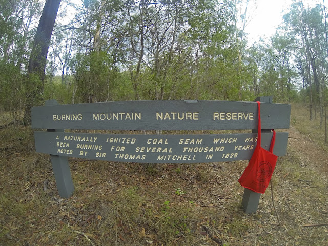
Burning Mountain, is also called “Mount Wingen”, is a hill near Wingen, New South Wales, Australia. It is located approximately 224 km north of Sydney just off the New England Highway. The mountain was discovered in 1828 by geologist T. L. Mitchell identified it as a coal seam fire. The name derives from a smoldering coal seam running underground through the sandstone, contained within the Burning Mountain Nature Reserve, which is administered by the NSW National Parks and Wildlife Service. A trail runs from the parking lots to the site where smoke emanates from the ground. The underground fire is estimated that the fire has burned for approximately 6,000 years and is the oldest known coal fire.
The underground fire is estimated to be at a depth of around 100 ft. Many explorers and settlers to the area believed the smoke, coming from the ground, was volcanic in origin. The coal fire is usually moving in a southerly direction at a rate of about 3 feet per year. The combustion has caused soil discoloration and an uneven ground surface in the area. Coal seams are extremely common across the world, and at any time there’re over 1000 burning. They happen regularly in lesser-developed mineral rich countries, but are often put out within a few days or at most a month. Moreover, considering the average duration of a coal seam fire, Mount Wingen’s fiery longevity has become something of a marvel across the globe and sightseers have flocked to observe the sulfur-tinged smoke emanating from the mountain. Though Mount Wingen has enticed sightseers in droves, it has also caused huge ecological damage to the area’s vegetation. The View from high up is very pretty and very interesting history and how the heat changes the landscape.
The Burning Mountain, heat and toxic gases from the fire have left it rocky and jagged in parts, and the land has caved in. How the mountain was first set ablaze is a mystery. Burning Mountain Nature Reserve has management strategies in place to protect and conserve the values of this park. The scientific explanation for Burning Mountain is a gradually combusting coal seam and as it eats through the coal, rocks slip into the gap, triggering fissures and slumping at the surface level. Moreover, you must be sure to wear sturdy footwear and stay on the formed track. Not only that, but watch out for fossils, too: 200 million years ago, this whole area was covered by ocean.


Thursday 27 April 2017

The Dolerite Columns of Coastal Tasmania

The coastline of the southern Tasmania is composed of spectacular rock columns that stick out up to 300 meters from the sea level. The geologists call these rocks are “dolerites”, due to its distinctive elongated shape and hexagonal columns. The Mother Nature majestic dolerite columns are probably formed in the Jurassic period, somewhere 185 million years ago during a massive volcanic event that covered up to a third of Tasmania. The doleritic clifts surpass 100 m in topography above the sea along much of the southern and eastern coast of Tasmania, and some singular columns occur as giant “totem poles” standing in the sea.

Dolerites are created when molten rocks pushed up from the deep underbelly of the earth cools rapidly and crystallize to form trifling visible crystals in the rock. However, when the rate of cooling is just right, the rocks trends to shrink in volume, because of creation of cracks. Thus, these cracks let the rocks in the interior to cool, resulting in additional cracks. Though at the end, you get a big block of rock with long vertical and symmetrical cracks creating 5 to 6 sided columns, can be just a few centimeters to over quite a lot of meters in diameter. The columns are actually a part of a continuous formation over 4,000 km long extending from Australia through Tasmania and into Antarctica.

The beautiful columnar rocks are not uncommon, as hundreds of recognized localities throughout the world where you can find them. Moreover, some of these locations are very famous such as The Giant’s Causeway in Ireland, The Devil’s Tower in Wyoming, Los Organos in Spain, and Fingal’s Cave in Scotland. The spectacular formations that, like these in Tasmania make him glorious tourist destinations.


Friday 3 March 2017

Bay of Fires, Tasmania in Australia


The Bay of Fires, on the northeastern coast of Tasmania in Australia, is a big bay that stretches for about 30 km from Binalong Bay in the south to Eddystone Point in the north. In 1773, the British navigator and explorer Captain Tobias Furneaux noticed various fires along the coast, which led him to trust that the country was densely populated. Evidence of settlement by aboriginal people can still be seen along the coast. The name Bay of Fires is associated by him, when he saw bay is characterized by white beaches, blue water and enormous granite blocks that are colored bright orange by lichens. The Bay of Fires is famous for its crystal-clear waters, white sandy beaches and orange lichen-covered granite boulders, the most popular conservation reserves. The conservation area is divided into three sections, with Anson's Bay dividing the southern and northern ends. A scenic view of the bay can be glimpsed by driving along the coast to The Gardens.
Perhaps, he named the bay after these fiery red rocks, no one knows? Moreover lichens are a mixture of algae and fungus that live together in a symbiotic relationship. The alga provides food by photosynthesis, though the fungus offers a protected environment for the algae. Thus, the combined life form has properties that are very distinct from the properties of its component organisms. Moreover, lichens are classified by their fungal component and are given the same scientific name as the fungus species in the lichen, regardless of what alga lives in the fungus.
The lichens responsible for the orange hue in the rocks of Bay of Fires belong to the family Hymeneliaceae. The beautiful color is contained in their thallus, which is the vegetative part of the body. Lichens are grouped by thallus type, since the thallus is generally the most visually protuberant part of the lichen. However in some lichens, the thallus is hard to distinguish. Which in result many lichens are remain unclassified? Aside from lichens, there’s a wealth of local wildlife to discover around the bay area, including corals birds, and the rich marine diversity that the reefs attract. Moreover, a wide range of activities are able to be pursued in the Bay of Fires area, including camping, beach activities, boating, bird watching, fishing, swimming, surfing, relaxing, walking, boat ramps, and rich marine biodiversity. But, be aware that Aboriginal middens “shell and bone deposits” are found in the sand dunes, hence do not disturb these protected sites.


Friday 17 February 2017

The Bungle Bungle Rane in Australia


The Bungle Bungle Range, in Purnululu National Park, is one of the most attractive geological landmarks in Western Australia. The Bungle Bungle range features unique beehive-shaped sandstone towers and conglomerates alternately striped in black and orange bands. The Bungle Bungle Range formation occupies an area of nearly 450 square kilometers. The Bungle Bungle Range is a spectacularly incised landscape was not really discovered as a travel destination until the mid-1800s. The researchers believed that the sedimentary rocks of Bungle Bungle were formed in the Ord Basin 350 million years ago, when active faults were altering the landscape. The stunning rocks rises up to 578 metres above sea level, and stand 200 to 300 metres above a woodland and grass-covered plain, with steep cliffs on the western face. If you’re flying over Bungle Bungle range, it is a striking sight. Moreover, the area was traditionally occupied by Karjaganujaru peoples; they’re living here for more than 20,000 years, having strong affiliation to this ancient landscape.

The joint effects of wind from the Tanami Desert and rainfall over millions of years shaped the domes. Although the formation appears solid, the sandstone is very brittle. The weight of overlying rock holds the sand grains in place, but when this is removed, the sandstones are without difficulty eroded. The rounded tops imitate this lack of internal strength. Moreover, the water flowing over the surface will exploit the softness and irregularities in the rock, such as cracks or joints, and swiftly erodes the narrow channels that separate the towers. Cyanobacteria can't grow here and without the protective coat the surface is exposed to "rusting". Thus, one of the most prominent features of the sandstones is the alternating black and orange or grey banding. However, the darker bands comprises of permeable layers of rock, which let water to move through with ease. As the water keeps the rock surface moist letting dark algae to grow on them. Hence, the less permeable layers in between are well covered with a patina of iron and manganese staining, producing the orange bands. These outer coatings support to keep the lower parts of the towers from erosion.

Furthermore, a 7 km diameter circular topographic feature is clearly visible on satellite images of the Bungle Bungle Range. It is supposed that this feature is the eroded leftover of a very early meteorite impact crater that maybe hit the area somewhere 250 million years ago. This beautiful structure is well known as the Piccaninny impact crater. The range remained largely unidentified except by local Aborigines and stockmen until 1982 when film-makers arrived in this area and produced a documentary about the Kimberley. The area was gazetted as a National Park in 1987 and was also inscribed as a World Heritage area in 2003.


Friday 4 September 2015

Kata Tjuta, A Group of Large Dome Formation in Central Australia

Kata Tjuta, is also called “Kata Joota”, and also famous as “Mount Olga” or colloquially as “The Olgas”, are a group of large domed rock formations “bornhardts” cover an area of 21.68 km2 located about 365 kilometers southwest of Alice Springs, in the southern part of the Northern Territory, central Australia. Both Uluru, and Kata Tjuta / Mount Olga form are the two major landmarks within the Uluru-Kata Tjuta National Park. The majestically beautiful 36 domes that made up of Kata Tjuta / Mount Olga are composed of conglomerate, a sedimentary rock containing of cobbles and boulders of varying rock types as well as granite and basalt, cemented by a matrix of sandstone. Moreover, the alternative name, “The Olgas”, comes from the tallest peak, Mt. Olga, which is, highest point is 3,497 feet above sea level. In 1872, Mt. Olga was given name by Ernest Giles in the honor of Queen Olga of Wurttemberg. In 15 December 1993, a dual naming policy was adopted that allowed official names both traditional Aboriginal name and the English name. As a result, Mount Olga was renamed Mount Olga / Kata Tjuta. However, on 6 November 2002, the dual name was officially reversed to Kata Tjuta / Mount Olga.

The region organized an event known as the Woodroff Thrust, thrust granulite facies rocks northward over low-grade metamorphic rocks. The ultimate erosion of the formation resulted in a molasse facies, or deposition in front of rising mountains, though in this case the Petermann Orogeny, to make the deposit recognized as the Mount Currie Conglomerate. The Mount Currie Conglomerate is made up of predominately of basalt, granite porphyry, gneiss and volcanic rock fragments with a matrix composed of angular quartz, microcline and orthoclase among other minerals. Anangu are the traditional owners of Uluru-Kata Tjuta and the land around and they have been at this place from unidentified time. Although Anangu people have connected to the area for thousands of years and some historical records advice they may have been there for more than 10,000 years. They have always known that this is a very special place. There’re “Many Head” the huge rocks are separated by steep-sided gorges and valleys. Walking tracks lead around the area to lookouts, waterholes and picnic areas, while the main trail, Valley of the Winds, is a 7.5-km loop.

Uluru-Kata Tjuta National Park is so-called Red Centre of the continent and is a UNESCO World Heritage area. Both Uluru “Ayers Rock” and the Kata Tjuta “Mount Olga” are made of sediment originating in this Mount Currie Conglomerate and both have a chemical composition alike to granite. Scientists predict the rock dating have been given it an age of 600 mya, matching the date of the Woodroof Thrust event. Therefore, the actual fresh rock that makes up the Kata Tjuta / Mount Olga and Uluru / Ayers Rock are medium to dark gray with green or pink hues in some laminae. The bright orange-red hue, for which the structures are noted, is due to a patina over finely divided feldspar coated in iron oxide.There are several Pitjantjatjara Dreamtime legends accompanying with this place and undeniably everything in the vicinity including, of course, Uluru / Ayers Rock. A vast number of legends surround the great snake king Wanambi who is said to live on the summit of Kata Tjuta / Mount Olga and only comes down during the dry season. The majority of mythology surrounding the site is not unveiled to outsiders in particular to women. As is the custom, should women become identified to the "men's business" they are susceptible to violent attacks, even death. Kata Tjuta / Mount Olga can be accessed via Ayers Rock Airport. It is then a 55 km drive south, then west. Tourists have to pay National Park entry fee. The park is protecting hundreds of plant species, 24 native mammal species and 72 reptile species. To protect these, off-road access away from Uluru and Kata Tjuta is not allowed.

Kata Tjuta is most beautiful when viewed at sunrise or sunset. If you’re after some serious adventure, you can even grasp how incredibly ancient and strangely imposing Kata Tjuta is by tackling the moderately hard Valley of the Winds Walk. It is highly suggest to walk early in the morning as it makes a much comfortable. Therefore, if the climate is suitable for walks then visitors are allowed to walk, hence if temperature is 36 degrees or more, then walk is closed from 11am at the Kalpa lookout. So, early morning walk is best to avoid disappointment. If the temperature is due to be 36 degrees or more then this walk is closed from 11am at the Kalpa Lookout, so get there early to avoid disappointment. Another 2km walk that is available is the Olga Gorge Walk (Tatintjawiya), which walks into the beautiful gorge. The nearest accommodation to the Olgas would be at the Ayers Rock Resort, where there is a range of accommodation to suit all tastes and budgets. There's a picnic and sunset-viewing area with its glorious, blood-red best at sunset.